File:Airphoto-Mestre.jpg

Size of this preview: 800 × 600 pixels. Other resolutions: 320 × 240 pixels | 640 × 480 pixels | 1,024 × 768 pixels | 1,280 × 960 pixels | 2,560 × 1,920 pixels | 2,848 × 2,136 pixels.
Original file (2,848 × 2,136 pixels, file size: 1.06 MB, MIME type: image/jpeg)
Captions
Captions
Add a one-line explanation of what this file represents
| Description |
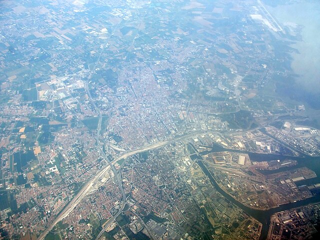
English: Airphoto of the suburbs of Venice, the area called Mestre (west of the old city). Marco Polo Airport can be seen in the upper right, and in the middle right, the habour areas are visible. The picture is captured during flight, in directly south–north direction, so the top of the picture points towards north.
Norsk bokmål: Luftfoto av forstedene til Venezia, området kalt Mestre (vest for gamlebyen). Marco Polo-flyplassen kan sees øverst til høyre, mens midt til høyre kan man se havneområdet. Bildet er tatt gjennom et flyvindu, i direkte sør–nord-retning, slik at toppen av bildet peker rett mot nord. |
||
| Date | |||
| Source | Own work | ||
| Author | Erik Fløan | ||
| Permission (Reusing this file) |
|
File history
Click on a date/time to view the file as it appeared at that time.
| Date/Time | Thumbnail | Dimensions | User | Comment | |
|---|---|---|---|---|---|
| current | 18:38, 29 June 2008 | | 2,848 × 2,136 (1.06 MB) | Efloean (talk | contribs) | {{Information |Description={{en|1=Airphoto of the suburbs of Venice, the area called Mestre (west of the old city). Marco Polo Airport can be seen in the upper right, and in the middle right, the habour areas are visible.}} {{no|1=Luftfoto av forstedene t |
You cannot overwrite this file.
File usage on Commons
The following page uses this file:
- File:Air photo of Mestre, Italy (4265939891).jpg (file redirect)
.jpg&redirect=no)
File usage on other wikis
The following other wikis use this file: