File:AlapahaRiver2002.jpg

Size of this preview: 800 × 600 pixels. Other resolutions: 320 × 240 pixels | 640 × 480 pixels | 1,024 × 768 pixels | 1,280 × 960 pixels | 2,010 × 1,507 pixels.
Original file (2,010 × 1,507 pixels, file size: 641 KB, MIME type: image/jpeg)
Captions
Captions
Add a one-line explanation of what this file represents
Summary edit
| Description |
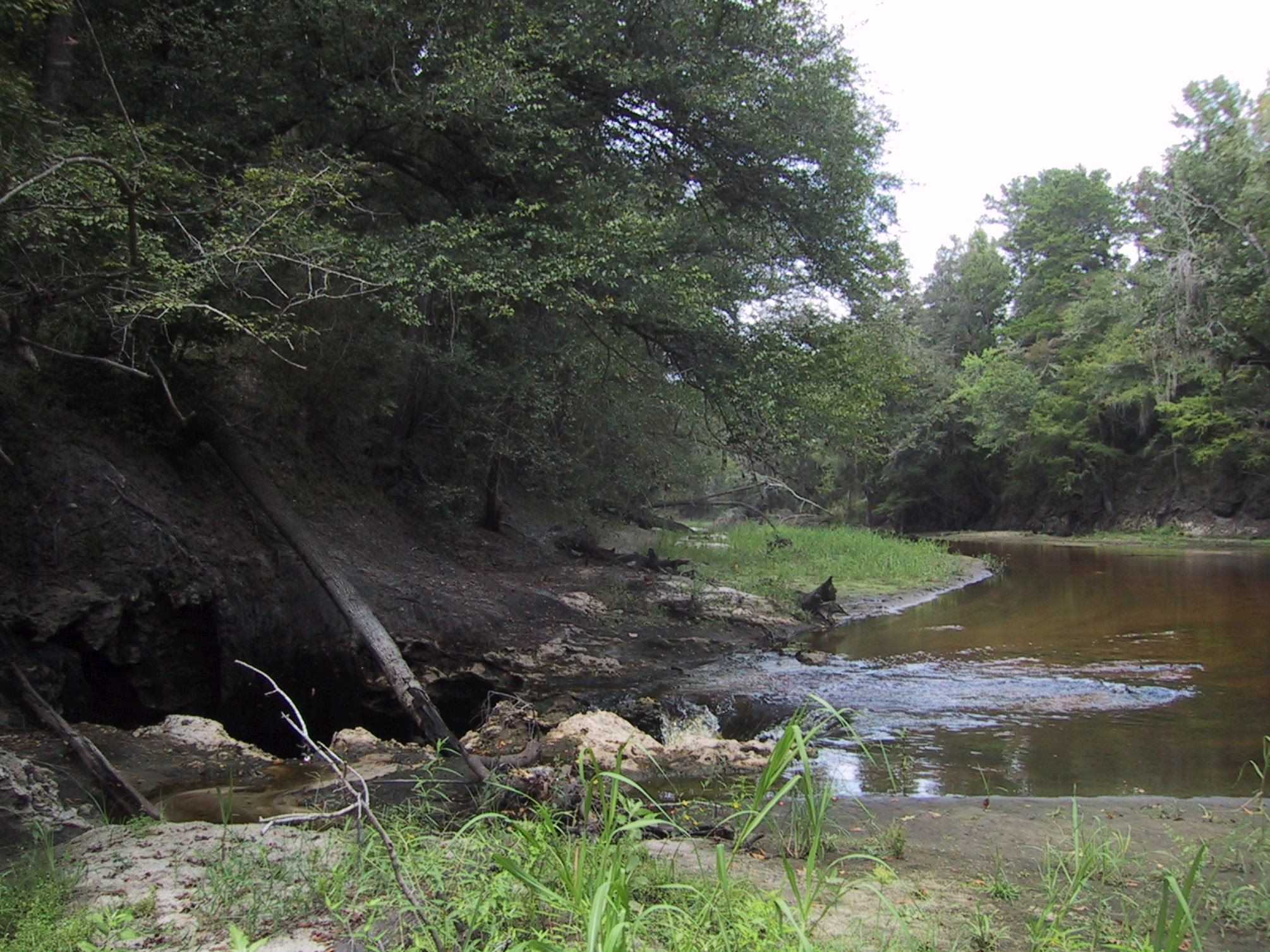
English: Surface water-Groundwater (SW-GW) interaction , August 2002. Entire flow of Alapaha River near Jennings going into sinkhole to Floridan Aquifer. Sinkholes are one of a variety of properties of Karst topographies and carstic underground water systems that develope world wide in water soluble (chemically soluble) rocks (in Florida: carbonate rocks). |
| Date | |
| Source | USGS Surface Water Photo Gallery[1], item 14 01. |
| Author | Stewart Tomlinson, Florida |
Licensing edit
This image is in the public domain in the United States because it only contains materials that originally came from the United States Geological Survey, an agency of the United States Department of the Interior. For more information, see the official USGS copyright policy.
|
Original upload log edit
The original description page was here. All following user names refer to en.wikipedia.
- 2008-09-01 03:17 Suntag 2010×1507× (656603 bytes)
File history
Click on a date/time to view the file as it appeared at that time.
| Date/Time | Thumbnail | Dimensions | User | Comment | |
|---|---|---|---|---|---|
| current | 20:52, 19 May 2012 | | 2,010 × 1,507 (641 KB) | MathewTownsend (talk | contribs) | {{Information |Description={{en|en:Surface water-en:Groundwater (SW-GW) interaction , August 2002. Entire flow of en:Alapaha River near en:Jennings, Florida going into en:sinkhole to en:Floridan Aquifer.<br> Sinkhole... |
You cannot overwrite this file.
File usage on Commons
There are no pages that use this file.
File usage on other wikis
The following other wikis use this file:
- Usage on ar.wikipedia.org
- Usage on az.wikipedia.org
- Usage on ckb.wikipedia.org
- Usage on en.wikipedia.org
- Usage on fa.wikipedia.org
- Usage on hi.wikipedia.org
- Usage on id.wikipedia.org
- Usage on ig.wikipedia.org
- Usage on ko.wikipedia.org
- Usage on ml.wikipedia.org
- Usage on mr.wikipedia.org
- Usage on pa.wikipedia.org
- Usage on simple.wikipedia.org
- Usage on su.wikipedia.org
- Usage on ta.wikipedia.org
- Usage on tr.wikipedia.org
- Usage on vi.wikipedia.org
- Usage on zh-yue.wikipedia.org