File:Alberta rivers.png
Size of this preview: 475 × 599 pixels. Other resolutions: 190 × 240 pixels | 381 × 480 pixels | 808 × 1,019 pixels.
Original file (808 × 1,019 pixels, file size: 1.15 MB, MIME type: image/png)
Captions
Captions
Add a one-line explanation of what this file represents
Summary edit
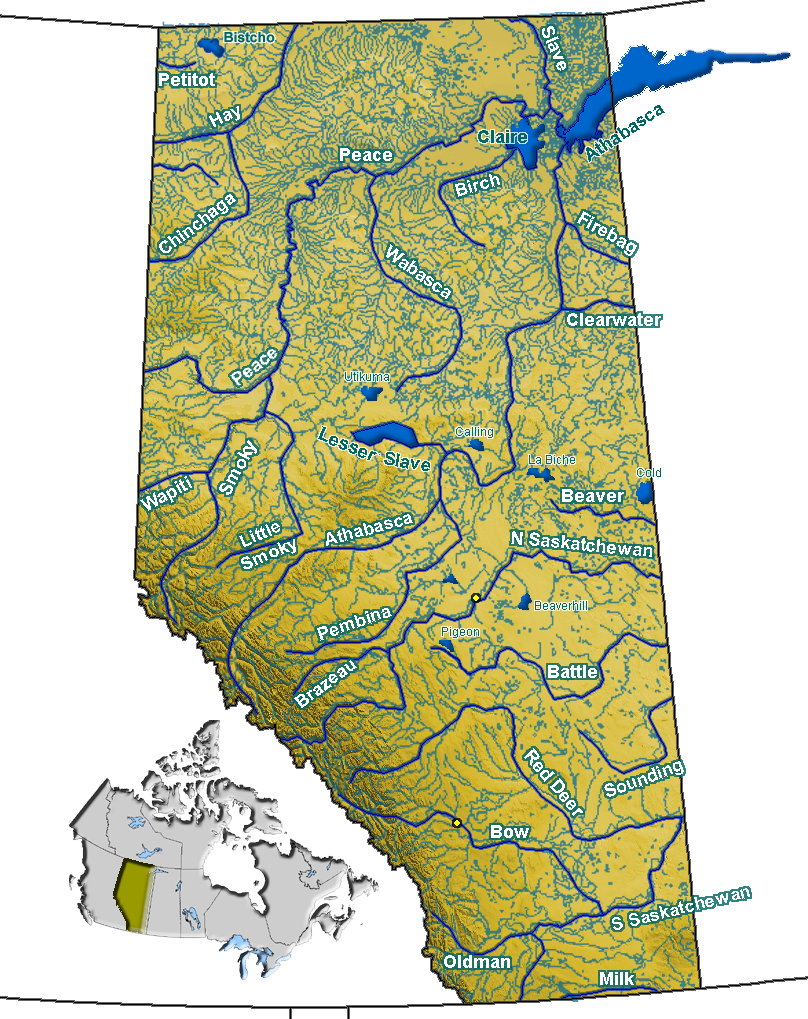
| Description | Rivers in Alberta, Canada |
| Date | |
| Source | GIS data |
| Author | Qyd |
| Permission (Reusing this file) |
All |
Licensing edit
| I, the copyright holder of this work, release this work into the public domain. This applies worldwide. In some countries this may not be legally possible; if so: I grant anyone the right to use this work for any purpose, without any conditions, unless such conditions are required by law. |
File history
Click on a date/time to view the file as it appeared at that time.
| Date/Time | Thumbnail | Dimensions | User | Comment | |
|---|---|---|---|---|---|
| current | 18:30, 27 November 2007 | | 808 × 1,019 (1.15 MB) | Qyd (talk | contribs) | fix lake name |
| 23:43, 9 September 2006 |  | 808 × 1,019 (1.15 MB) | Qyd (talk | contribs) | add some lakes, remove wrong rivers | |
| 20:43, 29 August 2006 |  | 808 × 1,019 (1.16 MB) | Qyd (talk | contribs) | emphase lake, creeks color | |
| 19:39, 29 August 2006 |  | 808 × 1,019 (1.15 MB) | Qyd (talk | contribs) | lakes | |
| 02:14, 22 August 2006 |  | 808 × 1,019 (1.17 MB) | Qyd (talk | contribs) | add names | |
| 01:41, 22 August 2006 |  | 808 × 1,128 (1.16 MB) | Qyd (talk | contribs) | {{Information |Description=Rivers in Alberta, Canada |Source=USGS data |Date=Aug 2006 |Author=Qyd |Permission=All |other_versions= }} Category:Maps of Alberta |
You cannot overwrite this file.
File usage on Commons
The following page uses this file:
File usage on other wikis
The following other wikis use this file:
- Usage on arz.wikipedia.org
- Usage on bg.wikipedia.org
- Usage on ca.wikipedia.org
- Usage on ceb.wikipedia.org
- Usage on cs.wikipedia.org
- Usage on de.wikipedia.org
- Usage on en.wikipedia.org
- Milk River (Alberta–Montana)
- Athabasca River
- List of rivers of Alberta
- South Saskatchewan River
- Geography of Alberta
- St. Mary River (Alberta–Montana)
- Lake Athabasca
- Battle Creek (Milk River tributary)
- Bow River
- Sunwapta River
- Hidden Lake (Alberta)
- Peace River
- Lake Minnewanka
- Moraine Lake
- Lesser Slave Lake
- Glenmore Reservoir
- Peace–Athabasca Delta
- Slave River
- Oldman River
- Peyto Lake
- Clearwater River (Alberta)
- Clearwater River (Saskatchewan)
- Athabasca Falls
- Sunwapta Falls
- Bow Falls
- Primrose Lake
- Maligne Lake
- Elbow River
- Category:Lakes of Alberta
- Lake Claire (Alberta)
- Red Deer River
- Elbow Falls
- Wabamun Lake
- Skeleton Lake (Alberta)
- Buffalo Lake (Alberta)
- Lake Agnes (Alberta)
- Category:Rivers of Alberta
View more global usage of this file.