File:Allendale Mill 1969.jpg

Size of this preview: 800 × 552 pixels. Other resolutions: 320 × 221 pixels | 640 × 442 pixels | 953 × 658 pixels.
Original file (953 × 658 pixels, file size: 106 KB, MIME type: image/jpeg)
Captions
Captions
Add a one-line explanation of what this file represents
Summary edit
| Description |
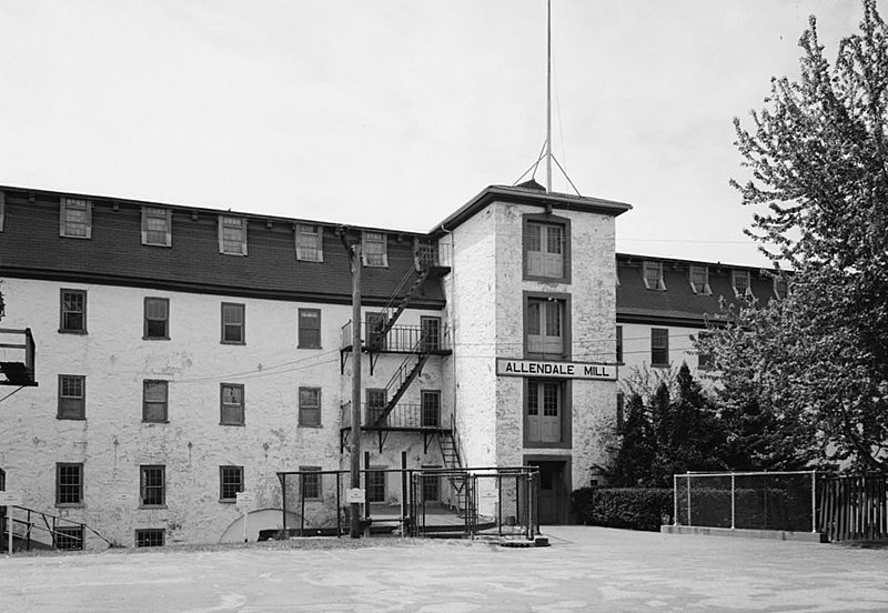
English: Allendale Mill — 494 Woonasquatucket Avenue, Centerdale, Providence County, Rhode Island — north elevation, looking west.
|
|||||||||||||||||||||||||
| Date | ||||||||||||||||||||||||||
| Source | Library of Congress, Prints and Photographs Division, Historic American Buildings Survey, HABS: RI,4-CENT,2-2 | |||||||||||||||||||||||||
| Author |
|
|||||||||||||||||||||||||
| Permission (Reusing this file) |
|
|||||||||||||||||||||||||

| Object location | | View this and other nearby images on: OpenStreetMap |
|---|

|
This image is available from the United States Library of Congress's Prints and Photographs division
under the digital ID hhh.ri0094. This tag does not indicate the copyright status of the attached work. A normal copyright tag is still required. See Commons:Licensing.
|
File history
Click on a date/time to view the file as it appeared at that time.
| Date/Time | Thumbnail | Dimensions | User | Comment | |
|---|---|---|---|---|---|
| current | 09:34, 11 April 2009 | | 953 × 658 (106 KB) | Cropbot (talk | contribs) | upload cropped version, operated by User:Finavon. Summary: border cropped |
| 20:11, 10 April 2009 |  | 1,024 × 733 (119 KB) | Marcbela (talk | contribs) | {{Information |Description={{en|1=Allendale Mill, 494 Woonasquatucket Avenue, Centerdale, Providence County, RI }} |Source=http://memory.loc.gov/pnp/habshaer/ri/ri0000/ri0094/photos/145082pv.jpg |Author=Jack Boucher |Date=1969 |Permission= |other_versions |
You cannot overwrite this file.
File usage on Commons
The following page uses this file:
File usage on other wikis
The following other wikis use this file:
- Usage on ca.wikipedia.org
- Usage on en.wikipedia.org
- Usage on fr.wikibooks.org
- Usage on www.wikidata.org