File:Allerhope Burn valley near Clennell - geograph.org.uk - 450527.jpg
No higher resolution available.
Allerhope_Burn_valley_near_Clennell_-_geograph.org.uk_-_450527.jpg (640 × 480 pixels, file size: 115 KB, MIME type: image/jpeg)
Captions
Captions
Add a one-line explanation of what this file represents
Summary edit
| Description |
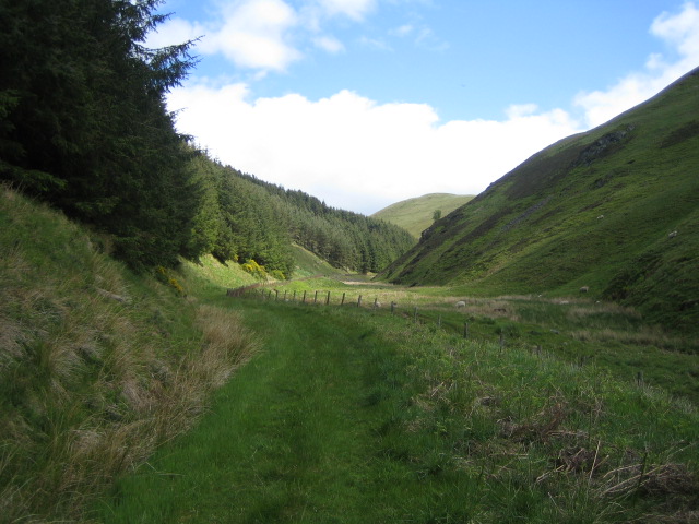
English: Allerhope Burn valley near Clennell The remote valley of the Allerhope Burn, which flows into the River Alwin about 1/4km behind the camera, has no buildings other than sheepfolds. The burn however is first mentioned, as Halrehopeburne, in the records of Newminster Abbey, which was near Morpeth, as forming part of the boundary in a grant of land made by Richard de Umfraville in 1226 http://www.northumberlandnationalpark.org.uk/understanding/historyarchaeology/historicvillageatlas/harbottleintroduction/harbottlehistory/newminstercharters.htm. The lower part of the valley is a Site of Special Scientific Interest (SSSI). A permissive footpath runs up the valley to Wether Cairn at 563m, and this route forms part of the annual Alwinton Round 15m and 20m walks organised by the North of Tyne Search & Rescue Team. |
| Date | |
| Source | From geograph.org.uk |
| Author | Andy Gryce |
| Attribution (required by the license) | Andy Gryce / Allerhope Burn valley near Clennell / |
| Camera location | | View this and other nearby images on: OpenStreetMap |
|---|
_heading:67.00&language=en)
| Object location | | View this and other nearby images on: OpenStreetMap |
|---|
_heading:67.00&language=en)
Licensing edit

|
This image was taken from the Geograph project collection. See this photograph's page on the Geograph website for the photographer's contact details. The copyright on this image is owned by Andy Gryce and is licensed for reuse under the Creative Commons Attribution-ShareAlike 2.0 license.
|
This file is licensed under the Creative Commons Attribution-Share Alike 2.0 Generic license.
Attribution: Andy Gryce
- You are free:
- to share – to copy, distribute and transmit the work
- to remix – to adapt the work
- Under the following conditions:
- attribution – You must give appropriate credit, provide a link to the license, and indicate if changes were made. You may do so in any reasonable manner, but not in any way that suggests the licensor endorses you or your use.
- share alike – If you remix, transform, or build upon the material, you must distribute your contributions under the same or compatible license as the original.
- Remove redundant categories and try to put this image in the most specific category/categories
- Remove this template
- The location categories are based on information from this geonames tool and this OpenStreetMap tool combined with a database. You can also have a look at this tool from mysociety.
- The topic category from Geograph was Valley (find similar images at Geograph)
File history
Click on a date/time to view the file as it appeared at that time.
| Date/Time | Thumbnail | Dimensions | User | Comment | |
|---|---|---|---|---|---|
| current | 14:07, 4 February 2011 | | 640 × 480 (115 KB) | GeographBot (talk | contribs) | == {{int:filedesc}} == {{Information |description={{en|1=Allerhope Burn valley near Clennell The remote valley of the Allerhope Burn, which flows into the River Alwin about 1/4km behind the camera, has no buildings other than sheepfolds. The burn however |
You cannot overwrite this file.
File usage on Commons
There are no pages that use this file.