File:Allison 2001 map.png
No higher resolution available.
Allison_2001_map.png (542 × 519 pixels, file size: 10 KB, MIME type: image/png)
Captions
Captions
Add a one-line explanation of what this file represents
Summary edit
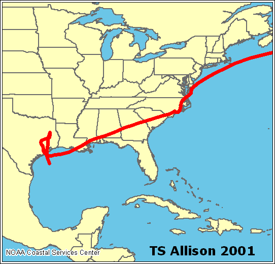
NOAA map archive copy at the Wayback Machine showing path of Tropical Storm Allison in 2001.
Licensing edit
This image is in the public domain because it contains materials that originally came from the U.S. National Oceanic and Atmospheric Administration, taken or made as part of an employee's official duties.
|
File history
Click on a date/time to view the file as it appeared at that time.
| Date/Time | Thumbnail | Dimensions | User | Comment | |
|---|---|---|---|---|---|
| current | 19:59, 16 July 2005 | | 542 × 519 (10 KB) | Jdorje~commonswiki (talk | contribs) | ==Summary== Path of Tropical Storm Allison in 2001. ==Copyright status== Taken from [http://www.nhc.noaa.gov/HAW2/english/history.shtml]. {{PD-USGov-NOAA}} |
You cannot overwrite this file.
File usage on Commons
There are no pages that use this file.