File:Alt Nordstrand 1634.jpg

Original file (11,329 × 10,200 pixels, file size: 14.31 MB, MIME type: image/jpeg)
Captions
Captions
Summary
edit| Warning | The original file is very high-resolution. It might not load properly or could cause your browser to freeze when opened at full size. |
|---|
| Description |
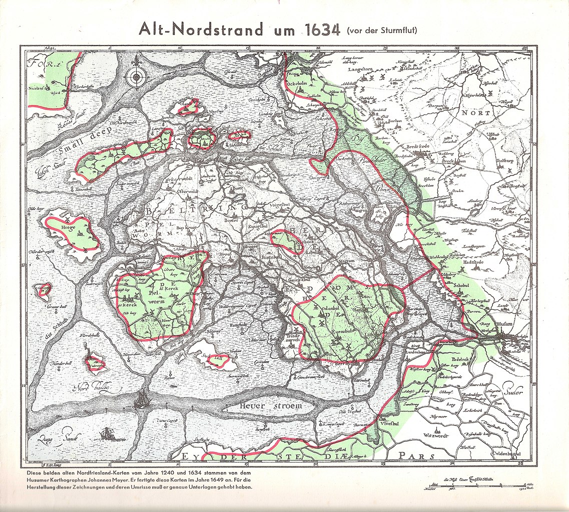
English: Nordfriesland map of Johannes Meyer around 1634 (before the storm surge). The red lines indicate the coastline at the time of the report template.
Deutsch: Nordfriesland-Karte von Johannes Meyer um 1634 (vor der Sturmflut). Die roten Linien geben den Küstenverlauf zur Zeit der Berichtsvorlage an. |
|||||||||||||||||
| Date | ||||||||||||||||||
| Source | Nordfriesland früher und heute, Bogdan Gisevius, Berlin W. | |||||||||||||||||
| Author |
|
|||||||||||||||||

Licensing
edit
|
This work is in the public domain in its country of origin and other countries and areas where the copyright term is the author's life plus 70 years or fewer.
| |
| This file has been identified as being free of known restrictions under copyright law, including all related and neighboring rights. | |
File history
Click on a date/time to view the file as it appeared at that time.
| Date/Time | Thumbnail | Dimensions | User | Comment | |
|---|---|---|---|---|---|
| current | 12:29, 26 May 2019 | | 11,329 × 10,200 (14.31 MB) | Hapebalf (talk | contribs) | Reduzierte Dateigröße |
| 18:50, 20 May 2019 |  | 11,329 × 10,200 (31.18 MB) | Hapebalf (talk | contribs) | {{Information |description ={{en|1=Nordfriesland map of Johannes Meyer around 1634 (before the storm surge)}} {{de|1=Nordfriesland-Karte von Johannes Meyer um 1634 (vor der Sturmflut)}} |date =1634 |source =Nordfriesland früher und heute, Bogdan Gisevius, Berlin W. |author =Johannes Meyer }} Category:Schleswig-Holstein |
You cannot overwrite this file.
File usage on Commons
There are no pages that use this file.
File usage on other wikis
The following other wikis use this file:
- Usage on de.wikipedia.org