File:Altenbrak Bode 02.jpg
Size of this preview: 800 × 481 pixels. Other resolutions: 320 × 193 pixels | 640 × 385 pixels | 1,024 × 616 pixels | 1,280 × 770 pixels | 2,560 × 1,540 pixels | 3,648 × 2,195 pixels.
Original file (3,648 × 2,195 pixels, file size: 2.72 MB, MIME type: image/jpeg)
Captions
Captions
Add a one-line explanation of what this file represents
Summary edit
| Description |
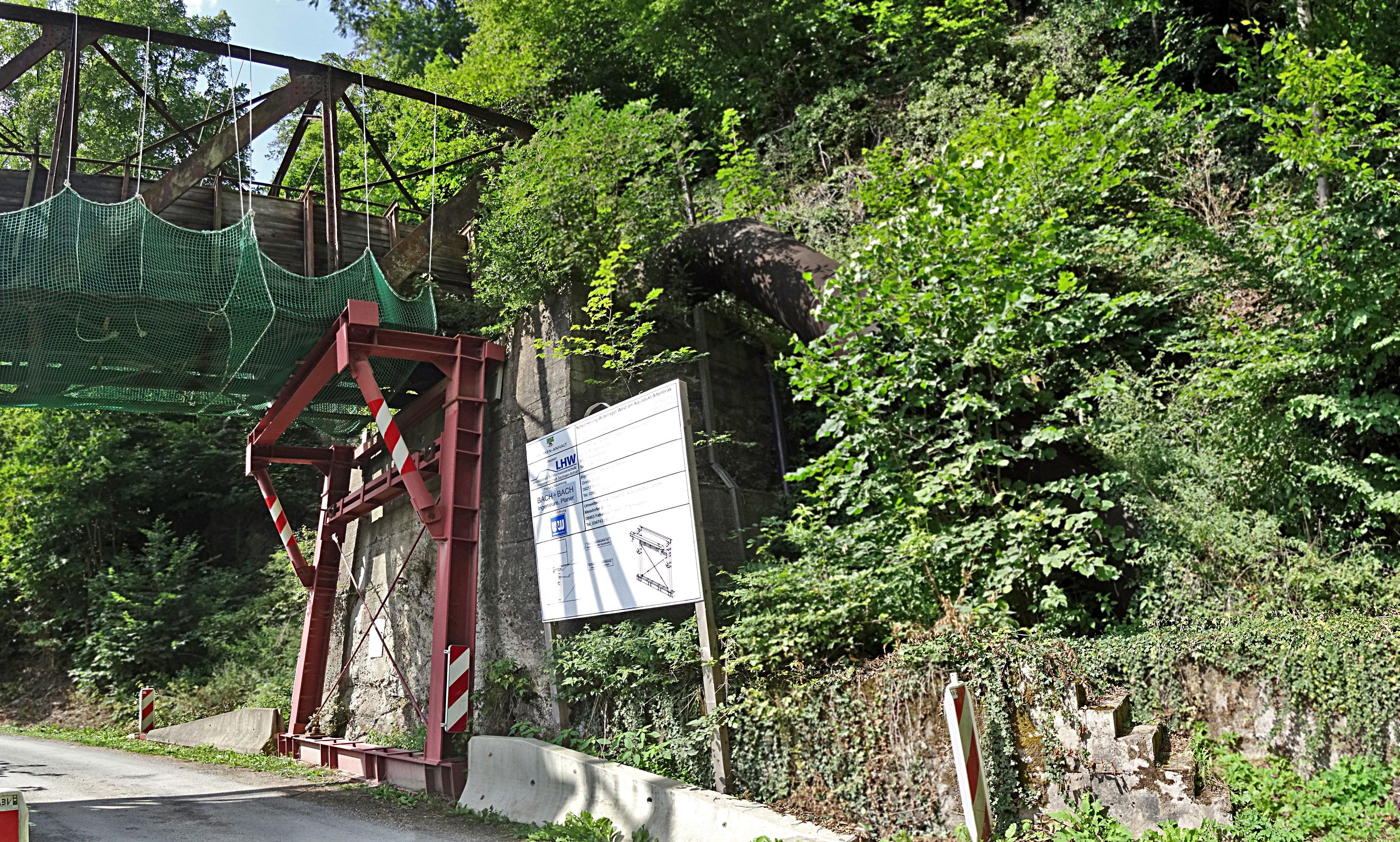
Deutsch: Alte Wasserbrücke Altenbrak (1878), über sie wurde Wasserkraft von der Talsperre Wendefurth durch einen Tunnel unter dem Bergrücken der Schöneburg hindurch zur Holzschleiferei geleitet, um dort Turbinen anzutreiben |
| Date | |
| Source | Own work |
| Author | ErwinMeier |
| Camera location | | View this and other nearby images on: OpenStreetMap |
|---|
Licensing edit
I, the copyright holder of this work, hereby publish it under the following license:
This file is licensed under the Creative Commons Attribution-Share Alike 4.0 International license.
- You are free:
- to share – to copy, distribute and transmit the work
- to remix – to adapt the work
- Under the following conditions:
- attribution – You must give appropriate credit, provide a link to the license, and indicate if changes were made. You may do so in any reasonable manner, but not in any way that suggests the licensor endorses you or your use.
- share alike – If you remix, transform, or build upon the material, you must distribute your contributions under the same or compatible license as the original.
File history
Click on a date/time to view the file as it appeared at that time.
| Date/Time | Thumbnail | Dimensions | User | Comment | |
|---|---|---|---|---|---|
| current | 17:10, 16 January 2023 | | 3,648 × 2,195 (2.72 MB) | ErwinMeier (talk | contribs) | Uploaded own work with UploadWizard |
You cannot overwrite this file.
File usage on Commons
The following page uses this file: