File:AltstadtBludenz7.jpg

Size of this preview: 600 × 600 pixels. Other resolutions: 240 × 240 pixels | 480 × 480 pixels | 768 × 768 pixels | 1,024 × 1,024 pixels | 2,048 × 2,048 pixels | 2,592 × 2,592 pixels.
Original file (2,592 × 2,592 pixels, file size: 3.54 MB, MIME type: image/jpeg)
Captions
Captions
Add a one-line explanation of what this file represents
| Description |
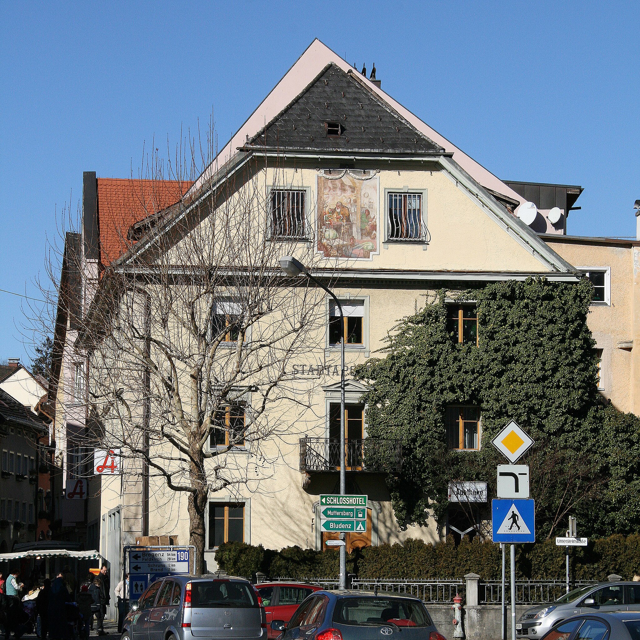
Deutsch: Werdenbergerstrasse Nr.26 (Stadtapotheke)in der Altstadt von Bludenz, Vorarlberg *** aus dem DEHIO Vorarlberg 1983: Dach traufseitig zur Strasse, Schleppgaupen, Dachuntersicht kassettiert; frühhistorische Fassadengliederung (Mitte 19. Jh.), Ortquaderung, Fensterverdachung gerade und dreieckig, Ladenschild; Giebelseite stadtauswärts abgewalmt (Krüppelwalmdach), drei Fensterachsen, Sturzbogenportal mit Stuckbekrönung, Ende 18. Jh., und Wappen, Medaillon mit zopfartiger Rahmung, Gitterbalkon auf Voluntenkonsolen, Giebelfresko (Alchimist), Portaltüre mit Löwentürklopfer, 4.V.18.Jh.
|
| Date | |
| Source | Own work |
| Author | böhringer friedrich |
| Permission (Reusing this file) |
I, the copyright holder of this work, hereby publish it under the following license: This file is licensed under the Creative Commons Attribution-Share Alike 2.5 Generic license.
|
This Photo was taken by Böhringer Friedrich.
|
Feel free to use my photos, but please mention me as the author and if you want send me a message. or (rufre@lenz-nenning.at) |
| Object location | | View this and other nearby images on: OpenStreetMap |
|---|
| Camera location | | View this and other nearby images on: OpenStreetMap |
|---|
Quelle: Dehio Vorarlberg
File history
Click on a date/time to view the file as it appeared at that time.
| Date/Time | Thumbnail | Dimensions | User | Comment | |
|---|---|---|---|---|---|
| current | 21:12, 12 February 2008 | | 2,592 × 2,592 (3.54 MB) | Böhringer (talk | contribs) | {{Information |Description= {{de| Werdenbergerstrasse Nr.26 (Stadtapotheke)in der Altstadt von Bludenz, Vorarlberg *** '''aus dem DEHIO Vorarlberg 1983:''' Dach traufseitig zur Strasse, Schleppgaupen, Dachuntersicht kasse |
You cannot overwrite this file.
File usage on Commons
There are no pages that use this file.
File usage on other wikis
The following other wikis use this file:
- Usage on de.wikipedia.org
- Usage on www.wikidata.org