File:Amboseli Airstrip 2017 02 crop.jpg

Size of this preview: 800 × 537 pixels. Other resolutions: 320 × 215 pixels | 640 × 430 pixels | 1,024 × 688 pixels | 1,280 × 860 pixels | 2,560 × 1,720 pixels | 4,092 × 2,749 pixels.
Original file (4,092 × 2,749 pixels, file size: 7.3 MB, MIME type: image/jpeg)
Captions
Captions
Add a one-line explanation of what this file represents
Summary edit
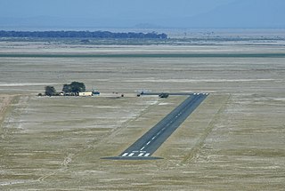
| Description |
Deutsch: Landepiste des Amboseli-Nationalparks in Kenia
English: Amboseli Airstrip |
| Date | |
| Source | (https://www.flickr.com/photos/flightlog/35951648561/) |
| Author | Photograph: flightlog / Bearbeitung (Ausschnitt erstellt, gedreht, farbig nachbelichtet, Tonwert und Kontrast korrigiert): Christoph Waghubinger (Lewenstein) |

| Camera location | | View this and other nearby images on: OpenStreetMap |
|---|
Licensing edit
This file is licensed under the Creative Commons Attribution 2.0 Generic license.
- You are free:
- to share – to copy, distribute and transmit the work
- to remix – to adapt the work
- Under the following conditions:
- attribution – You must give appropriate credit, provide a link to the license, and indicate if changes were made. You may do so in any reasonable manner, but not in any way that suggests the licensor endorses you or your use.
File history
Click on a date/time to view the file as it appeared at that time.
| Date/Time | Thumbnail | Dimensions | User | Comment | |
|---|---|---|---|---|---|
| current | 16:15, 12 July 2018 | | 4,092 × 2,749 (7.3 MB) | Lewenstein (talk | contribs) | =={{int:filedesc}}== {{Information |description={{de|1=Landepiste des {{wd|Amboseli-Nationalpark}}s in Kenia}} {{en|1={{w|Amboseli Airport|Amboseli Airstrip}}}} |date=2017-07-09 08:55:02 |source={{extracted from|Amboseli Airstrip 2017 02.jpg}} (https://www.flickr.com/photos/flightlog/35951648561/) |author={{Photo}}: [https://www.flickr.com/people/flightlog/ flightlog] / Bearbeitung (Ausschnitt erstellt, gedreht, farbig nachbelichtet, Tonwert und Kontrast korrigiert): Christoph Waghubinger ([[... |
You cannot overwrite this file.
File usage on Commons
The following 3 pages use this file:
File usage on other wikis
The following other wikis use this file:
- Usage on ceb.wikipedia.org
- Usage on de.wikipedia.org
- Usage on de.wikivoyage.org
- Usage on en.wikipedia.org
- Usage on nl.wikipedia.org
- Usage on pl.wikipedia.org
- Usage on ro.wikipedia.org
- Usage on sv.wikipedia.org
- Usage on www.wikidata.org