File:Amerique Meridionale 1783.jpg

Original file (9,048 × 6,498 pixels, file size: 41.69 MB, MIME type: image/jpeg)
Captions
Captions
| Warning | The original file is very high-resolution. It might not load properly or could cause your browser to freeze when opened at full size. |
|---|
Summary edit
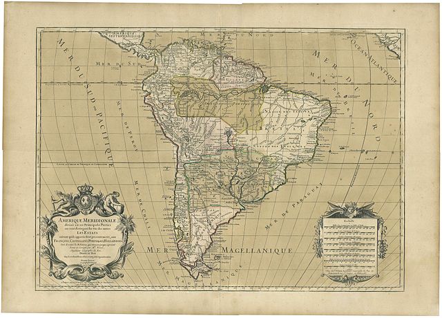
| Description |
French:
Amerique Meridionale divisée en ses Principales Parties ou sont distingués les uns des autres les Estats
suivant qu’ils appartiennent presentement, aux François, Castillans, Portugais, Hollandois &
Tirée de toutes les Relations, qui ont paru jusques apresent
Revuë et Corrigée par Mr. Brion, Ingénieur Géographe du Roi.
Dedié au Roy Par son tres humble, tres obeissant, tres fidele Sujet et Serviteur,
Hubert Jaillot. Geographe de Sa Majesté. English: Jaillot’s map of South America based on Sanson, printed by Desnos. |
||||||||||||||||||||||||||||||||||||||||||||||||||||
| Date | 17th century | ||||||||||||||||||||||||||||||||||||||||||||||||||||
| Source | Scan of a map published in 1783 | ||||||||||||||||||||||||||||||||||||||||||||||||||||
| Author |
|
||||||||||||||||||||||||||||||||||||||||||||||||||||
| Other versions | http://www.raremaps.com/gallery/archivedetail/0798/Amerique_Meridionale_divisee_en_ses_Principales_Partiesa/Jaillot.html | ||||||||||||||||||||||||||||||||||||||||||||||||||||


Licensing edit
|
This work is in the public domain in its country of origin and other countries and areas where the copyright term is the author's life plus 100 years or fewer. | |
| This file has been identified as being free of known restrictions under copyright law, including all related and neighboring rights. | |
File history
Click on a date/time to view the file as it appeared at that time.
| Date/Time | Thumbnail | Dimensions | User | Comment | |
|---|---|---|---|---|---|
| current | 23:53, 4 May 2013 | | 9,048 × 6,498 (41.69 MB) | Rolgiati (talk | contribs) | User created page with UploadWizard |
You cannot overwrite this file.
File usage on Commons
There are no pages that use this file.
File usage on other wikis
The following other wikis use this file:
- Usage on en.wikipedia.org
- Usage on fr.wikipedia.org