File:Ana Oct 18 2014 2100Z (Worldview).jpg

Size of this preview: 478 × 600 pixels. Other resolutions: 191 × 240 pixels | 382 × 480 pixels | 612 × 768 pixels | 816 × 1,024 pixels | 1,632 × 2,048 pixels | 4,769 × 5,985 pixels.
Original file (4,769 × 5,985 pixels, file size: 3.07 MB, MIME type: image/jpeg)
Captions
Captions
Add a one-line explanation of what this file represents
Summary edit
| Description |
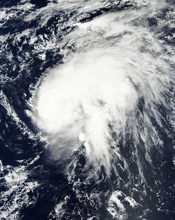
English: Hurricane Ana on October 18. Hawaiian Islands, located noreast of its LLCC (center), were covered by its rainbands. Español: El huracán Ana el 18 de octubre, las islas Hawái, localizadas al noreste del LLCC (centro), fueron cubiertos por sus bandas nubosas. |
| Date | |
| Source | http://map2.vis.earthdata.nasa.gov/imagegen/index.php?TIME=2014291&extent=-162.05805644482,12.328125,-151.58149394482,25.4765625&epsg=4326&layers=MODIS_Terra_CorrectedReflectance_TrueColor&format=image/jpeg&width=4769&height=5985 |
| Author | MODIS/NASA/NOAA |
| Other versions |

.jpg&action=edit§ion=1)
Licensing edit
.jpg&action=edit§ion=2)
| This file is in the public domain in the United States because it was solely created by NASA. NASA copyright policy states that "NASA material is not protected by copyright unless noted". (See Template:PD-USGov, NASA copyright policy page or JPL Image Use Policy.) | ||
 |
Warnings:
|
File history
Click on a date/time to view the file as it appeared at that time.
| Date/Time | Thumbnail | Dimensions | User | Comment | |
|---|---|---|---|---|---|
| current | 03:28, 19 October 2014 | | 4,769 × 5,985 (3.07 MB) | Byralaal (talk | contribs) | User created page with UploadWizard |
You cannot overwrite this file.
File usage on Commons
The following 2 pages use this file:
- File:Ana Oct 18 2014 2100Z.jpg
- File:Ana Oct 18 2014 2100z.jpg (file redirect)
.jpg&oldid=791788271)