File:Anacostia River Valley - US Army Corps of Engineers - middle portion only - 1891.jpg
Size of this preview: 800 × 324 pixels. Other resolutions: 320 × 129 pixels | 640 × 259 pixels | 1,024 × 414 pixels | 1,280 × 518 pixels | 5,000 × 2,022 pixels.
Original file (5,000 × 2,022 pixels, file size: 10.32 MB, MIME type: image/jpeg)
Captions
Captions
Add a one-line explanation of what this file represents
Summary edit
| Description |
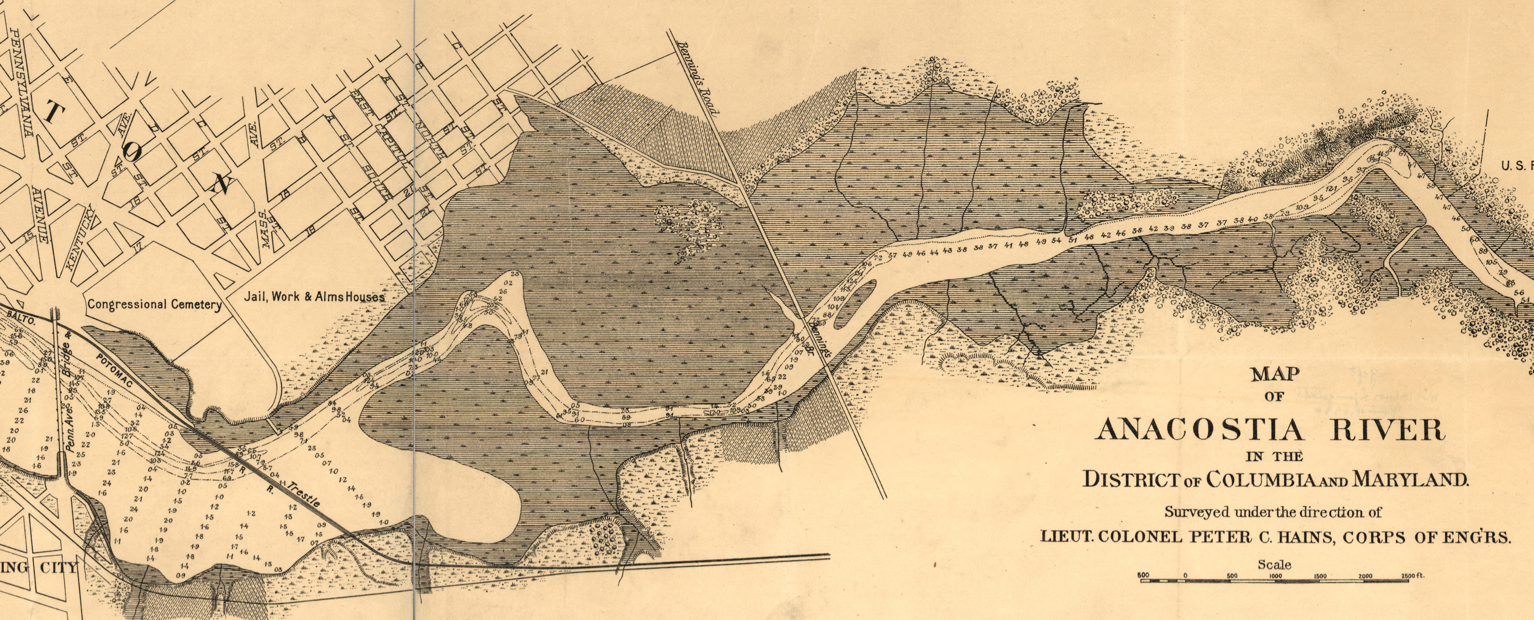
English: Middle porton of a map of the en:Anacostia River in the en:District of Columbia, surveyed and created on October 24, 1891, by Lieutenant Colonel Peter C. Hains, U.S. Army Corps of Engineers. Note the location of the "Anacostia flats," the tidal marshes due to be filled in by the Corps of Engineers. |
| Date | |
| Source | http://hdl.loc.gov/loc.gmd/g3852a.ct001351 |
| Author | U.S. Army Corps of Engineers. Geography and Map Division, Library of Congress. Peter C. Hains, engineer and mapmaker. |
Licensing edit
This file is a work of a U.S. Army soldier or employee, taken or made as part of that person's official duties. As a work of the U.S. federal government, it is in the public domain in the United States.
|
 |
File history
Click on a date/time to view the file as it appeared at that time.
| Date/Time | Thumbnail | Dimensions | User | Comment | |
|---|---|---|---|---|---|
| current | 17:26, 16 August 2010 | 5,000 × 2,022 (10.32 MB) | Tim1965 (talk | contribs) | {{Information |Description={{en|1=Middle porton of a map of the en:Anacostia River in the en:District of Columbia, surveyed and created on October 24, 1891, by Lieutenant Colonel Peter C. Hains, U.S. Army Corps of Engineers. Note the location of |
You cannot overwrite this file.
File usage on Commons
There are no pages that use this file.
File usage on other wikis
The following other wikis use this file:
- Usage on en.wikipedia.org