File:Angers (Maine-et-Loire) (15142327759).jpg

Original file (4,957 × 3,307 pixels, file size: 6.02 MB, MIME type: image/jpeg)
Captions
Captions
Summary edit
_(15142327759).jpg&action=edit§ion=1)
| Description |
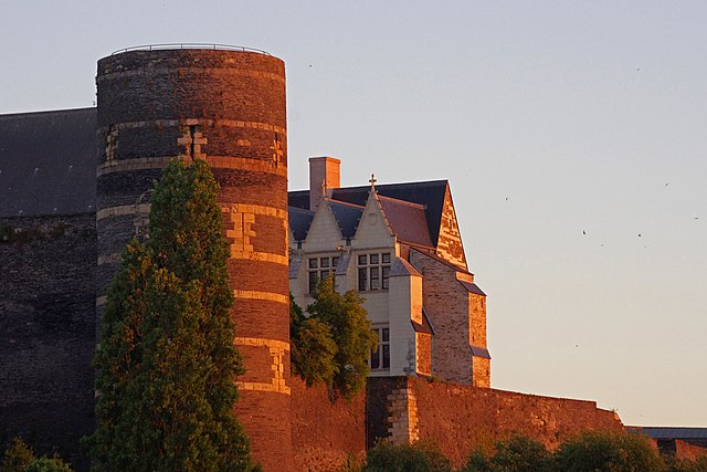
Angers (Maine-et-Loire) Le château (Château des ducs d'Anjou). La Tour du Moulin.
The Tower Mill. Moment in the religious wars, King Henry III gave the order to raze the Citadel: King fears that the citadel was conquered and used by Protestants. Governor Donadieu de Puycharic does not execute immediately the king's order. Demolition works are stopped. The castle is still standing. But the towers were decapitated and have lost their nice conical roofs. The mill which covered the Tour Mill has now disappeared. The mill was used to produce flour for the garrison, even if the blockade. Inside the courtyard, a second castle, the Logis Royal, was built in the fifteenth, for approval. The building has undergone a major fire in 2009. |
| Date | Taken on 19 June 2014, 21:43 |
| Source | Angers (Maine-et-Loire) |
| Author | Daniel Jolivet |
| Camera location | | View this and other nearby images on: OpenStreetMap |
|---|
_(15142327759).jpg¶ms=047.473075_N_-000.558312_E_globe:Earth_type:camera_source:Flickr_&language=en)
Licensing edit
_(15142327759).jpg&action=edit§ion=2)
- You are free:
- to share – to copy, distribute and transmit the work
- to remix – to adapt the work
- Under the following conditions:
- attribution – You must give appropriate credit, provide a link to the license, and indicate if changes were made. You may do so in any reasonable manner, but not in any way that suggests the licensor endorses you or your use.
| This image was originally posted to Flickr by sybarite48 at https://flickr.com/photos/26082117@N07/15142327759 (archive). It was reviewed on 14 November 2017 by FlickreviewR 2 and was confirmed to be licensed under the terms of the cc-by-2.0. |
File history
Click on a date/time to view the file as it appeared at that time.
| Date/Time | Thumbnail | Dimensions | User | Comment | |
|---|---|---|---|---|---|
| current | 15:42, 14 November 2017 | | 4,957 × 3,307 (6.02 MB) | Thesupermat2 (talk | contribs) | Transferred from Flickr via Flickr2Commons |
You cannot overwrite this file.
File usage on Commons
There are no pages that use this file.
_(15142327759).jpg&oldid=795522455)