File:Apollo 10 Analysis Figure 2-48.png
Size of this preview: 639 × 600 pixels. Other resolutions: 256 × 240 pixels | 511 × 480 pixels | 785 × 737 pixels.
Original file (785 × 737 pixels, file size: 286 KB, MIME type: image/png)
Captions
Captions
Add a one-line explanation of what this file represents
Summary edit
| Description |
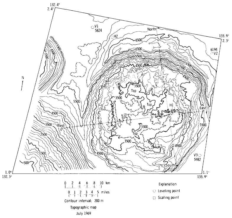
English: Topographic map of Green M crater, on the far side of the moon. This is Figure 2-48 of Analysis of Apollo 10 Photography and Visual Observations (NASA SP-232, 1971), which has the following caption:
|
| Date | |
| Source | Analysis of Apollo 10 Photography and Visual Observations, NASA Special Publication 232, 1971 |
| Author | NASA |
Licensing edit
| This file is in the public domain in the United States because it was solely created by NASA. NASA copyright policy states that "NASA material is not protected by copyright unless noted". (See Template:PD-USGov, NASA copyright policy page or JPL Image Use Policy.) | ||
 |
Warnings:
|
File history
Click on a date/time to view the file as it appeared at that time.
| Date/Time | Thumbnail | Dimensions | User | Comment | |
|---|---|---|---|---|---|
| current | 21:18, 28 September 2023 | | 785 × 737 (286 KB) | Jstuby (talk | contribs) | Uploaded a work by NASA from ''Analysis of Apollo 10 Photography and Visual Observations'', NASA Special Publication 232, 1971 with UploadWizard |
You cannot overwrite this file.
File usage on Commons
There are no pages that use this file.
File usage on other wikis
The following other wikis use this file:
- Usage on en.wikipedia.org