File:Approximate Boundaries of the City of Henrico in 1619.jpg
Size of this preview: 800 × 599 pixels. Other resolutions: 320 × 240 pixels | 640 × 479 pixels | 1,024 × 767 pixels | 1,040 × 779 pixels.
Original file (1,040 × 779 pixels, file size: 324 KB, MIME type: image/jpeg)
Captions
Captions
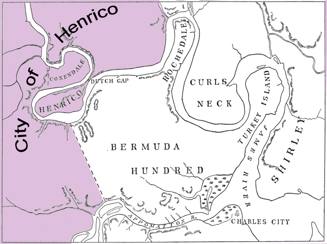
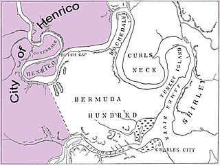
Approximate Boundaries of the City of Henrico in 1619 according to Historian Alexander Brown
Summary edit
| Description |
English: This is a map of the Approximate Boundaries of the City of Henrico in 1619 according to Historian Alexander Brown in his book, The First Republic of America. Base of May is from map in T. J. Wertenbacker's (1914) Virginia Under the Stuarts, underlying map image taken from Wikimedia Commons image: Virginia Under the Stuarts - Dale's Settlements.png |
| Date | |
| Source | Own work |
| Author | Wtfiv |
Licensing edit
I, the copyright holder of this work, hereby publish it under the following license:
This file is licensed under the Creative Commons Attribution-Share Alike 4.0 International license.
- You are free:
- to share – to copy, distribute and transmit the work
- to remix – to adapt the work
- Under the following conditions:
- attribution – You must give appropriate credit, provide a link to the license, and indicate if changes were made. You may do so in any reasonable manner, but not in any way that suggests the licensor endorses you or your use.
- share alike – If you remix, transform, or build upon the material, you must distribute your contributions under the same or compatible license as the original.
File history
Click on a date/time to view the file as it appeared at that time.
| Date/Time | Thumbnail | Dimensions | User | Comment | |
|---|---|---|---|---|---|
| current | 00:54, 5 April 2020 | | 1,040 × 779 (324 KB) | Wtfiv (talk | contribs) | Includes Label |
| 00:22, 5 April 2020 |  | 1,040 × 779 (306 KB) | Wtfiv (talk | contribs) | Uploaded own work with UploadWizard |
You cannot overwrite this file.
File usage on Commons
There are no pages that use this file.
File usage on other wikis
The following other wikis use this file:
- Usage on en.wikipedia.org