File:Arctic sea Ice September Extent Anomalies.png

Size of this preview: 800 × 457 pixels. Other resolutions: 320 × 183 pixels | 640 × 366 pixels | 1,260 × 720 pixels.
Original file (1,260 × 720 pixels, file size: 148 KB, MIME type: image/png)
Captions
Captions
Add a one-line explanation of what this file represents
Summary edit
| Description |
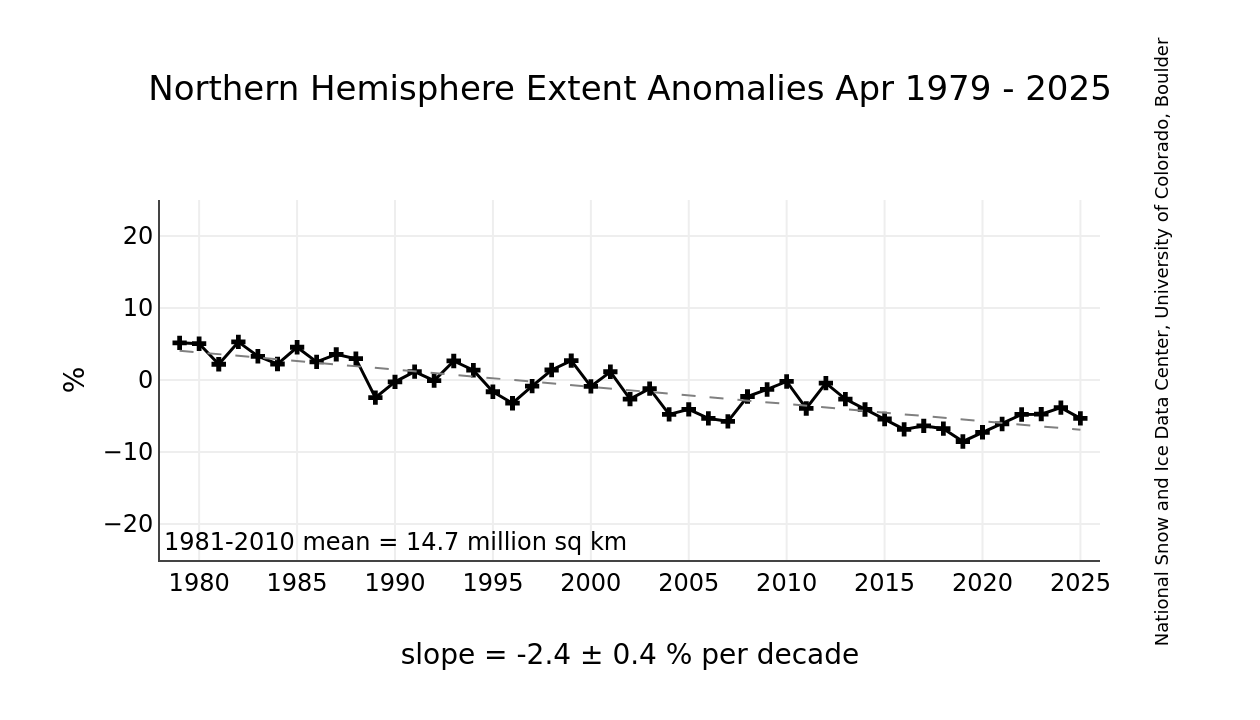
English: This graph shows monthly ice extent anomalies plotted as a time series of percent difference between the extent for the month in question and the mean for that month based on the January 1981 to December 2010 data. The anomaly data points are plotted as plus signs and the trend line is plotted with a dashed grey line. |
| Date | |
| Source |
http://nsidc.org/data/seaice_index/ http://nsidc.org/data/seaice_index/images/n_plot_hires.png |
| Author | National Snow and Ice Data Center |
Licensing edit
This work is in the public domain in the United States because it is a work prepared by an officer or employee of the United States Government as part of that person’s official duties under the terms of Title 17, Chapter 1, Section 105 of the US Code.
Note: This only applies to original works of the Federal Government and not to the work of any individual U.S. state, territory, commonwealth, county, municipality, or any other subdivision. This template also does not apply to postage stamp designs published by the United States Postal Service since 1978. (See § 313.6(C)(1) of Compendium of U.S. Copyright Office Practices). It also does not apply to certain US coins; see The US Mint Terms of Use.
|
 | |
| This file has been identified as being free of known restrictions under copyright law, including all related and neighboring rights. | ||
File history
Click on a date/time to view the file as it appeared at that time.
| Date/Time | Thumbnail | Dimensions | User | Comment | |
|---|---|---|---|---|---|
| current | 05:58, 7 October 2013 | | 1,260 × 720 (148 KB) | Sagredo (talk | contribs) | User created page with UploadWizard |
You cannot overwrite this file.
File usage on Commons
There are no pages that use this file.