File:Area 51 Groom Lake.jpg

Size of this preview: 800 × 563 pixels. Other resolutions: 320 × 225 pixels | 640 × 451 pixels | 804 × 566 pixels.
Original file (804 × 566 pixels, file size: 88 KB, MIME type: image/jpeg)
Captions
Captions
Add a one-line explanation of what this file represents
Summary
| Description |
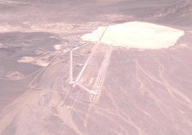
Română: Zona 51: Vedere aeriana simulata folosind imagini Landsat |
| Date | |
| Source | Landsat |
| Author | NASA |
| The Landsat satellite data used for this image came from Global Land Cover Facility (GLCF). The 3-D effects are processed with Kashmir 3D. |
Licensing

|
Permission is granted to copy, distribute and/or modify this document under the terms of the GNU Free Documentation License, Version 1.2 or any later version published by the Free Software Foundation; with no Invariant Sections, no Front-Cover Texts, and no Back-Cover Texts. A copy of the license is included in the section entitled GNU Free Documentation License. |
File history
Click on a date/time to view the file as it appeared at that time.
| Date/Time | Thumbnail | Dimensions | User | Comment | |
|---|---|---|---|---|---|
| current | 18:10, 30 September 2013 | | 804 × 566 (88 KB) | Gikü (talk | contribs) | User created page with UploadWizard |
You cannot overwrite this file.
File usage on Commons
There are no pages that use this file.
File usage on other wikis
The following other wikis use this file:
- Usage on ro.wikipedia.org
- Usage on vi.wikipedia.org