File:Area picnic vicino a La Piazza.jpg
Size of this preview: 800 × 583 pixels. Other resolutions: 320 × 233 pixels | 640 × 467 pixels | 1,024 × 746 pixels | 1,280 × 933 pixels | 2,560 × 1,866 pixels | 7,144 × 5,208 pixels.
Original file (7,144 × 5,208 pixels, file size: 7.35 MB, MIME type: image/jpeg)
File information
Structured data
Captions
Summary edit
DescriptionArea picnic vicino a La Piazza.jpg |
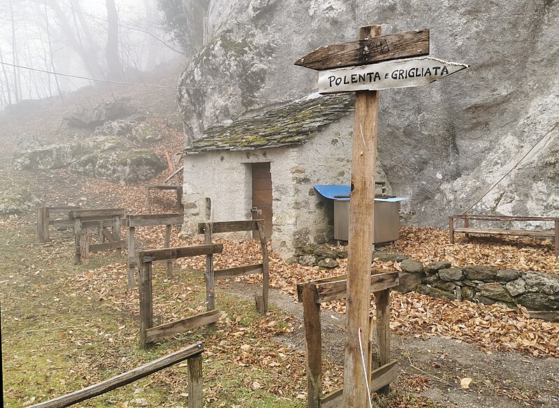
Italiano: Area picnic gestita dagli Alpini di Plesio, lungo la Via dei Monti Lariani 3, in località Pianca della Rana (poco prima di La Piazza, arrivando da Barna) |
Date | |
Source | Own work |
Author | Kaitu |
Camera location | 46° 02′ 36.26″ N, 9° 12′ 54.99″ E | View this and other nearby images on: OpenStreetMap | 46.043405; 9.215275 |
---|
Licensing edit
I, the copyright holder of this work, hereby publish it under the following license:
This file is licensed under the Creative Commons Attribution-Share Alike 4.0 International license.
- You are free:
- to share – to copy, distribute and transmit the work
- to remix – to adapt the work
- Under the following conditions:
- attribution – You must give appropriate credit, provide a link to the license, and indicate if changes were made. You may do so in any reasonable manner, but not in any way that suggests the licensor endorses you or your use.
- share alike – If you remix, transform, or build upon the material, you must distribute your contributions under the same or compatible license as the original.
Annotations InfoField | This image is annotated: View the annotations at Commons |
3724
205
2420
1215
7144
5208
Fake guidepost, giving direction to polenta and barbecue.
File history
Click on a date/time to view the file as it appeared at that time.
Date/Time | Thumbnail | Dimensions | User | Comment | |
---|---|---|---|---|---|
current | 16:03, 4 July 2022 | 7,144 × 5,208 (7.35 MB) | Kaitu (talk | contribs) | Uploaded own work with UploadWizard |
You cannot overwrite this file.
File usage on Commons
The following 2 pages use this file:
Metadata
This file contains additional information such as Exif metadata which may have been added by the digital camera, scanner, or software program used to create or digitize it. If the file has been modified from its original state, some details such as the timestamp may not fully reflect those of the original file. The timestamp is only as accurate as the clock in the camera, and it may be completely wrong.
Camera manufacturer | HUAWEI |
---|---|
Camera model | VOG-L29 |
Exposure time | 2,349/500,000 sec (0.004698) |
F-number | f/1.6 |
ISO speed rating | 50 |
Date and time of data generation | 11:51, 1 March 2020 |
Lens focal length | 5.56 mm |
Latitude | 46° 2′ 36.26″ N |
Longitude | 9° 12′ 54.99″ E |
Altitude | 811.783 meters above sea level |
Orientation | Normal |
Horizontal resolution | 96 dpi |
Vertical resolution | 96 dpi |
Software used | GIMP 2.10.30 |
File change date and time | 17:53, 4 July 2022 |
Y and C positioning | Centered |
Exposure Program | Normal program |
Exif version | 2.1 |
Date and time of digitizing | 11:51, 1 March 2020 |
Meaning of each component |
|
Image compression mode | 0.9 |
APEX shutter speed | 29.8973 |
APEX aperture | 1.35 |
APEX exposure bias | 0 |
Maximum land aperture | 1.35 APEX (f/1.6) |
Metering mode | Pattern |
Light source | Daylight |
Flash | Flash did not fire, auto mode |
DateTime subseconds | 970902 |
DateTimeOriginal subseconds | 970902 |
DateTimeDigitized subseconds | 970902 |
Supported Flashpix version | 1 |
Color space | sRGB |
Sensing method | One-chip color area sensor |
File source | Digital still camera |
Scene type | A directly photographed image |
Custom image processing | Custom process |
Exposure mode | Auto exposure |
White balance | Auto white balance |
Digital zoom ratio | 1 |
Focal length in 35 mm film | 27 mm |
Scene capture type | Standard |
Scene control | None |
Contrast | Normal |
Saturation | Normal |
Sharpness | Normal |
Subject distance range | Unknown |
GPS time (atomic clock) | 10:51 |
Speed unit | Kilometers per hour |
Speed of GPS receiver | 6.9070170636007 |
Reference for direction of image | True direction |
Direction of image | 123.11 |
GPS date | 1 March 2020 |
GPS tag version | 0.0.3.2 |
Unique ID of original document | xmp.did:1df0227b-aaa4-435c-8be2-710f31fb1de3 |