File:Argyllshire locator map.svg

Size of this PNG preview of this SVG file: 652 × 599 pixels. Other resolutions: 261 × 240 pixels | 522 × 480 pixels | 836 × 768 pixels | 1,114 × 1,024 pixels | 2,228 × 2,048 pixels | 915 × 841 pixels.
Original file (SVG file, nominally 915 × 841 pixels, file size: 909 KB)
Captions
Captions
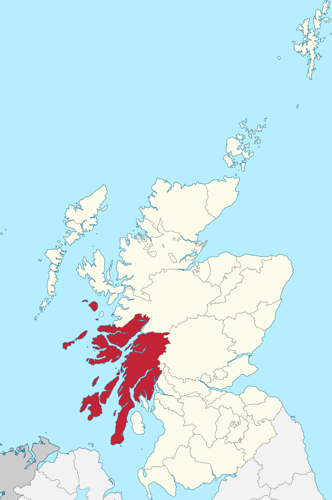
Locator map of the historic Scottish county of Argyllshire
Summary edit
| Description |
English: Locator map of the historic Scottish county of Argyllshire, using English Wikipedia locator maps conventions |
||
| Date | |||
| Source | Own work based on: Argyllshire Brit Isles Sect 2.svg by Visitor from Wikishire | ||
| Author | OwenBlacker | ||
| Permission (Reusing this file) |
|
||
| SVG development |
Licensing edit
I, the copyright holder of this work, hereby publish it under the following license:
| This file is made available under the Creative Commons CC0 1.0 Universal Public Domain Dedication. | |
| The person who associated a work with this deed has dedicated the work to the public domain by waiving all of their rights to the work worldwide under copyright law, including all related and neighboring rights, to the extent allowed by law. You can copy, modify, distribute and perform the work, even for commercial purposes, all without asking permission.
|
File history
Click on a date/time to view the file as it appeared at that time.
| Date/Time | Thumbnail | Dimensions | User | Comment | |
|---|---|---|---|---|---|
| current | 01:05, 24 March 2019 | | 915 × 841 (909 KB) | OwenBlacker (talk | contribs) | User created page with UploadWizard |
You cannot overwrite this file.
File usage on Commons
There are no pages that use this file.