File:Arlbergbahn km054ImstPitzal1990BEV.jpg

Size of this preview: 800 × 488 pixels. Other resolutions: 320 × 195 pixels | 640 × 390 pixels | 1,024 × 624 pixels | 1,324 × 807 pixels.
Original file (1,324 × 807 pixels, file size: 145 KB, MIME type: image/jpeg)
Captions
Captions
Add a one-line explanation of what this file represents
Summary edit
| Description |
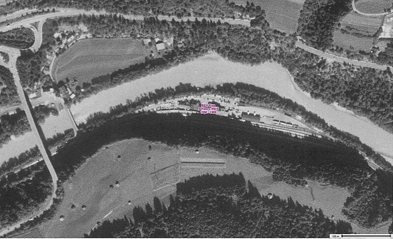
Deutsch: Screenshot Laser- & Luftbildatlas Tirol Arlbergbahn Km 55, Bahnhof Imst-Pitztal, ca. 1950.
English: Screenshot laser & aerial photo atlas Tyrol Arlbergbahn Km 55, Imst-Pitztal train station, approx. 1990. |
| Date | circa 1990 |
| Source | https://lba.tirol.gv.at/public/karte.xhtml |
| Author | Land Tirol – data.tirol.gv.at |
Licensing edit
This file is licensed under the Creative Commons Attribution 4.0 International license.
- You are free:
- to share – to copy, distribute and transmit the work
- to remix – to adapt the work
- Under the following conditions:
- attribution – You must give appropriate credit, provide a link to the license, and indicate if changes were made. You may do so in any reasonable manner, but not in any way that suggests the licensor endorses you or your use.
File history
Click on a date/time to view the file as it appeared at that time.
| Date/Time | Thumbnail | Dimensions | User | Comment | |
|---|---|---|---|---|---|
| current | 12:17, 12 April 2024 | | 1,324 × 807 (145 KB) | OhneEisen (talk | contribs) | Uploaded a work by Land Tirol – data.tirol.gv.at from https://lba.tirol.gv.at/public/karte.xhtml with UploadWizard |
You cannot overwrite this file.
File usage on Commons
The following 2 pages use this file: