File:Asphalt volcanoes bathymetry.jpg
Size of this preview: 800 × 600 pixels. Other resolutions: 320 × 240 pixels | 640 × 480 pixels | 1,024 × 768 pixels | 1,200 × 900 pixels.
Original file (1,200 × 900 pixels, file size: 381 KB, MIME type: image/jpeg)
Captions
Captions
Add a one-line explanation of what this file represents
Summary
edit
| Description |
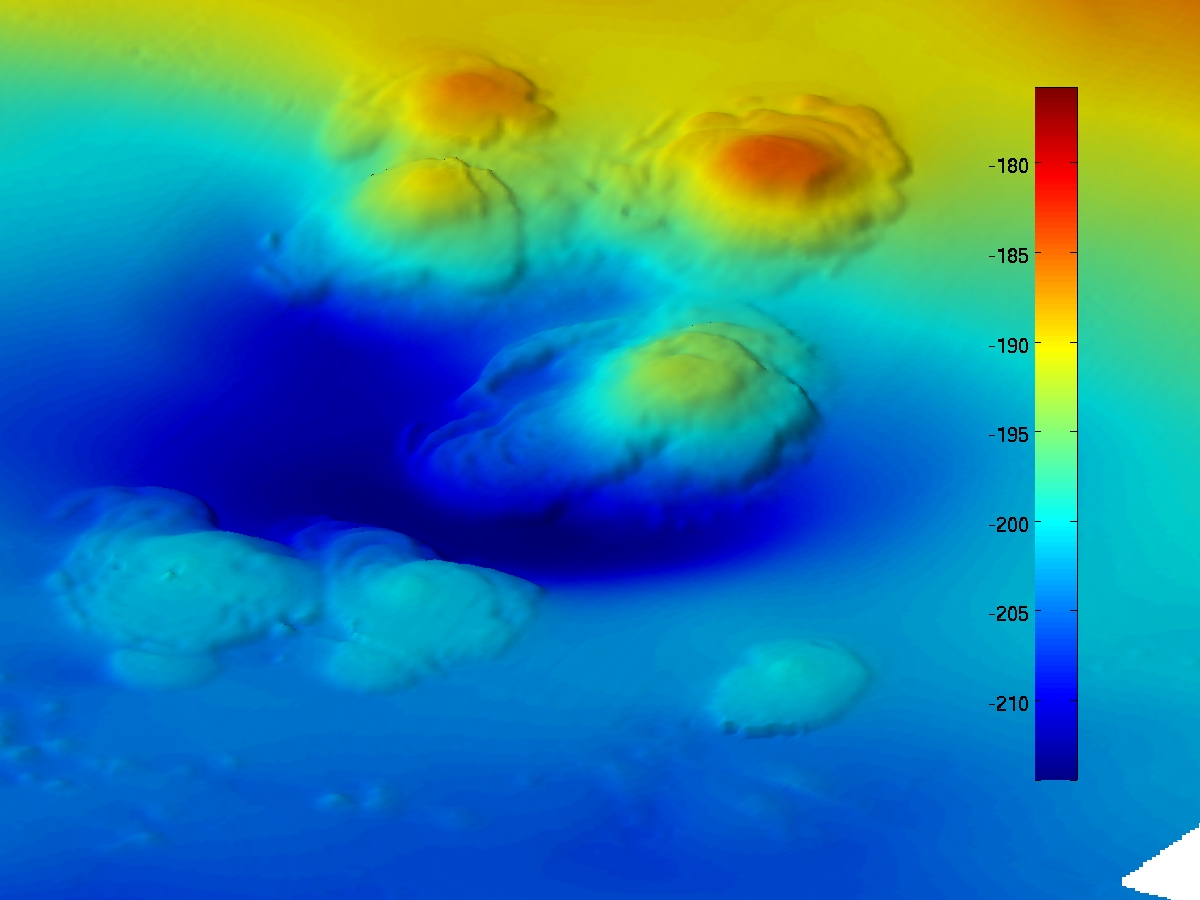
English: Bathymetry of seven extinct asphalt volcanoes on the floor of the Pacific Ocean, about 10 miles off the coast near Santa Barbara, California, USA. Collected using the autonomous underwater vehicle Sentry. Scale is in meters. Water depth is about 700 feet. The volcanoes were formed about 35,000 years ago. |
| Date | before 2010-04-26 |
| Source | Description page Direct link, news release |
| Author | Dana Yoerger, Woods Hole Oceanographic Institution |
Licensing
edit
| This image is a work of a National Science Foundation employee, taken or made as part of that person's official duties. As a work of the U.S. federal government, the image is in the public domain. |  |
Original upload log
edit
The original description page was here. All following user names refer to en.wikipedia.
| Date/Time | Dimensions | User | Comment |
|---|---|---|---|
| 2010-04-30 00:35 | 1200×900× (390609 bytes) | Resident Mario | {{Information |Description = Bathymetry of the seven [[asphalt volcano|asphalt volcanoes]] in the region of Santa Barbara. |Source = [http://www.nsf.gov/news/news_images.jsp?cntn_id=116785&org=NSF Description page] [http://www.nsf.gov/news/mm |
File history
Click on a date/time to view the file as it appeared at that time.
| Date/Time | Thumbnail | Dimensions | User | Comment | |
|---|---|---|---|---|---|
| current | 05:50, 25 September 2014 | | 1,200 × 900 (381 KB) | Innotata (talk | contribs) | Transferred from en.wikipedia |
You cannot overwrite this file.
File usage on Commons
The following page uses this file:
File usage on other wikis
The following other wikis use this file:
- Usage on en.wikipedia.org
- Usage on www.wikidata.org