File:Athlone On The Shannon River -b.jpg

Size of this preview: 800 × 533 pixels. Other resolutions: 320 × 213 pixels | 640 × 427 pixels | 1,024 × 683 pixels | 1,280 × 853 pixels | 2,560 × 1,707 pixels | 5,616 × 3,744 pixels.
Original file (5,616 × 3,744 pixels, file size: 10.04 MB, MIME type: image/jpeg)
Captions
Captions
Add a one-line explanation of what this file represents
Summary
edit
| Description |
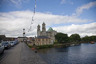
The following is the author's description of the photograph quoted directly from the photograph's Flickr page. "Despite being more than 300 km (200 miles) long, it rises only 76 m (250 feet) above sea level, so the river is easily navigable, with only a few locks along its length. There is a hydroelectric generation plant at Ardnacrusha belonging to the ESB. Shipping in Shannon estuary was developed extensively during the 1980s, with over IR£2 billion (%u20AC2.5Billion) investment. A tanker terminal at Foynes and an oil jetty at Shannon Airport were built. In 1982 a large scale alumina extraction plant was built at Aughinish. 60,000 tonne cargo vessels now carry raw bauxite from West African mines to the plant, where it is refined to alumina. This is then exported to Canada where it is further refined to aluminium. 1985 saw the opening of a huge coal-fired electricity plant at Moneypoint, fed by regular visits by 150,000 tonne bulk carriers. " |
||
| Date | |||
| Source |
originally posted to Flickr as Athlone On The Shannon River
|
||
| Author | William Murphy | ||
| Permission (Reusing this file) |
This file is licensed under the Creative Commons Attribution-Share Alike 2.0 Generic license.
|
| Camera location | | View this and other nearby images on: OpenStreetMap |
|---|
File history
Click on a date/time to view the file as it appeared at that time.
| Date/Time | Thumbnail | Dimensions | User | Comment | |
|---|---|---|---|---|---|
| current | 00:34, 14 December 2009 | | 5,616 × 3,744 (10.04 MB) | Geo Swan (talk | contribs) | {{Information |Description=The following is the author's description of the photograph quoted directly from the photograph's Flickr page.<br/>"Despite being more than 300 km (200 miles) long, it rises only 76 m (250 feet) above sea level, so the river is |
You cannot overwrite this file.
File usage on Commons
There are no pages that use this file.