File:Atlantic Archipelago.jpg
Size of this preview: 490 × 599 pixels. Other resolutions: 196 × 240 pixels | 393 × 480 pixels | 628 × 768 pixels | 838 × 1,024 pixels | 1,676 × 2,048 pixels | 3,600 × 4,400 pixels.
Original file (3,600 × 4,400 pixels, file size: 1.45 MB, MIME type: image/jpeg)
Captions
Captions
Add a one-line explanation of what this file represents
Summary edit
| Description |
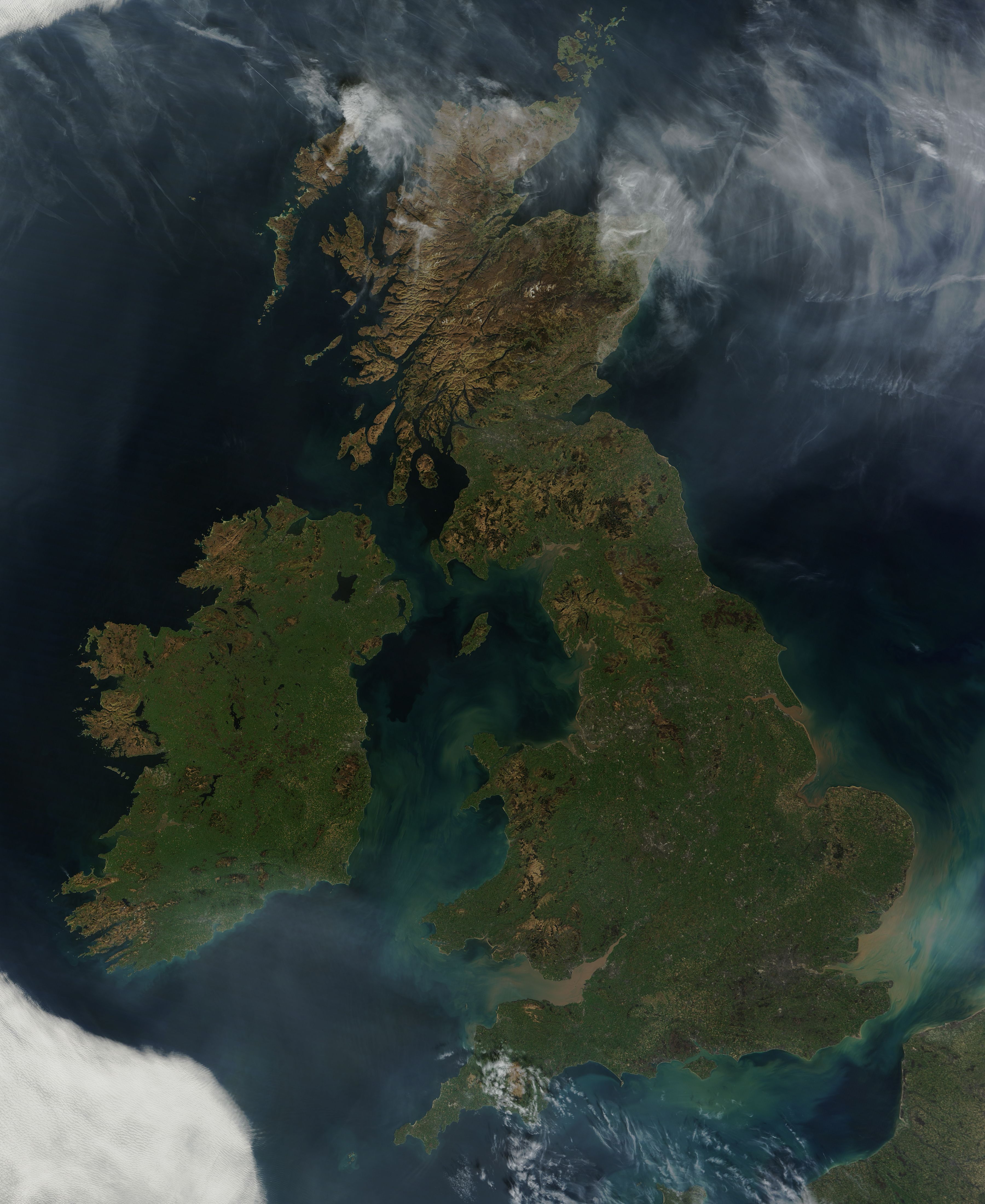
English: This nearly cloud-free view of Great Britain and Ireland was acquired by the Moderate Resolution Imaging Spectroradiometer (MODIS) aboard NASA’s Terra satellite on March 26, 2012. Just a few days into spring, most of the land appears green, although not quite as brilliant as the summertime hues that give Ireland the nickname “the Emerald Island”. |
| Date | |
| Source | http://modis.gsfc.nasa.gov/gallery/images/image03282012_250m.jpg |
| Author | MODIS Land Rapid Response Team, NASA GSFC |
Licensing edit
| This file is in the public domain in the United States because it was solely created by NASA. NASA copyright policy states that "NASA material is not protected by copyright unless noted". (See Template:PD-USGov, NASA copyright policy page or JPL Image Use Policy.) | ||
 |
Warnings:
|
File history
Click on a date/time to view the file as it appeared at that time.
| Date/Time | Thumbnail | Dimensions | User | Comment | |
|---|---|---|---|---|---|
| current | 14:17, 31 May 2012 | | 3,600 × 4,400 (1.45 MB) | EverydayMuffin (talk | contribs) |
You cannot overwrite this file.
File usage on Commons
The following page uses this file:
- File:Great Britain and Ireland (7021760921).jpg (file redirect)
.jpg&redirect=no)
File usage on other wikis
The following other wikis use this file:
- Usage on war.wikipedia.org