File:Auckland NZ 1840-60.jpg

Size of this preview: 685 × 599 pixels. Other resolutions: 274 × 240 pixels | 549 × 480 pixels | 878 × 768 pixels | 1,170 × 1,024 pixels | 2,000 × 1,750 pixels.
Original file (2,000 × 1,750 pixels, file size: 894 KB, MIME type: image/jpeg)
Captions
Captions
Add a one-line explanation of what this file represents
Summary
edit| Description |
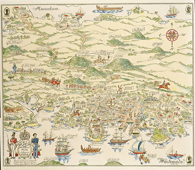
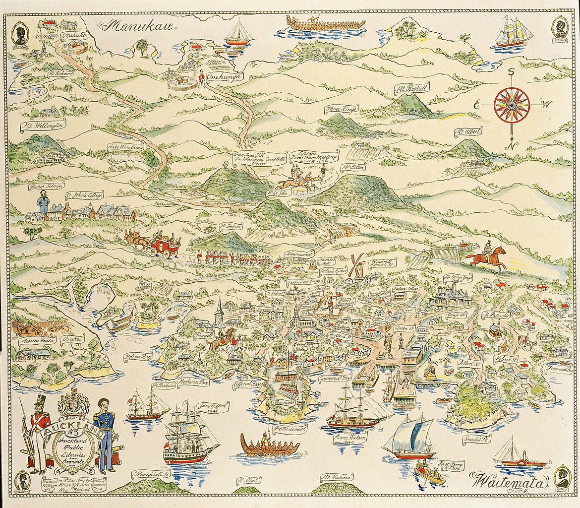
English: A pictorial map of places around Auckland City and isthmus from 1840 to 1860, drawn and hand-coloured in 1951 and signed J.C.H. (John Cecil Hill). He was the Auckland Star's first cartoonist, holding the position 1927 to 1952.
Auckland Libraries Heritage Collections Map 5673 |
| Date | |
| Source | https://kura.aucklandlibraries.govt.nz/digital/collection/maps/id/1229/rec/3 |
| Author | John Cecil Hill of the Auckland Star |
| Other versions |
.jpg)
Licensing
edit
|
This work is in the public domain in its country of origin and other countries and areas where the copyright term is the author's life plus 70 years or fewer. This work is in the public domain in the United States because it was published (or registered with the U.S. Copyright Office) before January 1, 1929. | |
| This file has been identified as being free of known restrictions under copyright law, including all related and neighboring rights. | |
File history
Click on a date/time to view the file as it appeared at that time.
| Date/Time | Thumbnail | Dimensions | User | Comment | |
|---|---|---|---|---|---|
| current | 12:12, 17 November 2021 | | 2,000 × 1,750 (894 KB) | Prosperosity (talk | contribs) | Uploaded a work by John Cecil Hill of the Auckland Star from https://kura.aucklandlibraries.govt.nz/digital/collection/maps/id/1229/rec/3 with UploadWizard |
You cannot overwrite this file.
File usage on Commons
The following page uses this file:
File usage on other wikis
The following other wikis use this file:
- Usage on en.wikipedia.org
- Usage on es.wikipedia.org
- Usage on sl.wikipedia.org