File:Augsburg, Lech - Topographischer Atlas vom Königreiche Baiern.jpg
Size of this preview: 248 × 599 pixels. Other resolutions: 99 × 240 pixels | 198 × 480 pixels | 317 × 768 pixels | 1,053 × 2,545 pixels.
Original file (1,053 × 2,545 pixels, file size: 744 KB, MIME type: image/jpeg)
Captions
Captions
Add a one-line explanation of what this file represents
| Description |
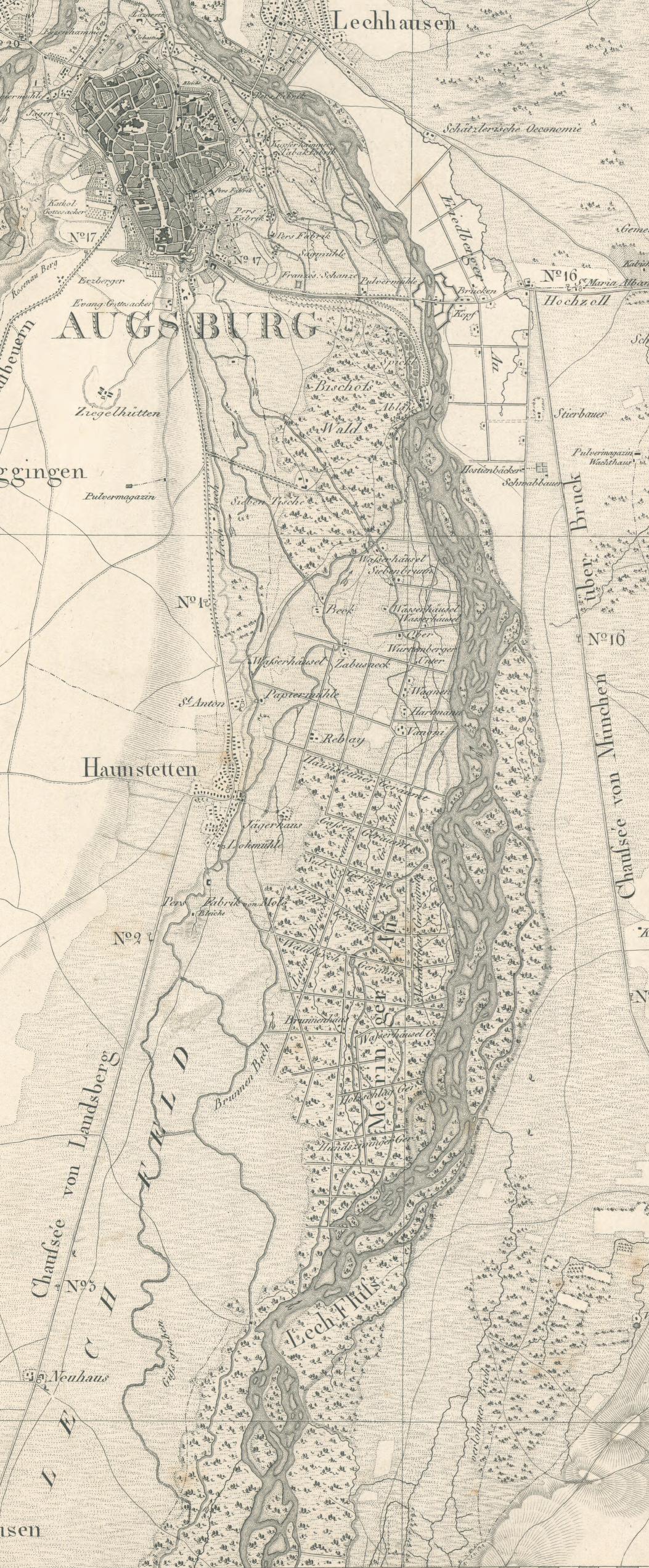
Deutsch: Augsburg, Topographischer Atlas vom Königreiche Baiern, 1:50000, Blatt 69 (Ausschnitt) |
||||
| Date | before 1830 | ||||
| Source | http://daten.digitale-sammlungen.de/~db/0001/bsb00011206/images/ | ||||
| Author | Thomas Green, Topographisches Bureau München | ||||
| Permission (Reusing this file) |
|
||||
| Other versions |
|
||||

File history
Click on a date/time to view the file as it appeared at that time.
| Date/Time | Thumbnail | Dimensions | User | Comment | |
|---|---|---|---|---|---|
| current | 10:06, 17 January 2014 | 1,053 × 2,545 (744 KB) | Thgoiter (talk | contribs) | {{Information |Description ={{de|1=Augsburg, Topographischer Atlas vom Königreiche Baiern, 1:50000, Blatt 69 (Ausschnitt)}} |Source =http://daten.digitale-sammlungen.de/~db/0001/bsb00011206/images/ |Author =[[:de:Thomas Green (Karto... |
You cannot overwrite this file.
File usage on Commons
The following 2 pages use this file: