File:Ausbreitungroemischesreich.png
Size of this preview: 800 × 479 pixels. Other resolutions: 320 × 192 pixels | 640 × 384 pixels | 1,218 × 730 pixels.
Original file (1,218 × 730 pixels, file size: 256 KB, MIME type: image/png)
Captions
Captions
Add a one-line explanation of what this file represents
Summary
edit
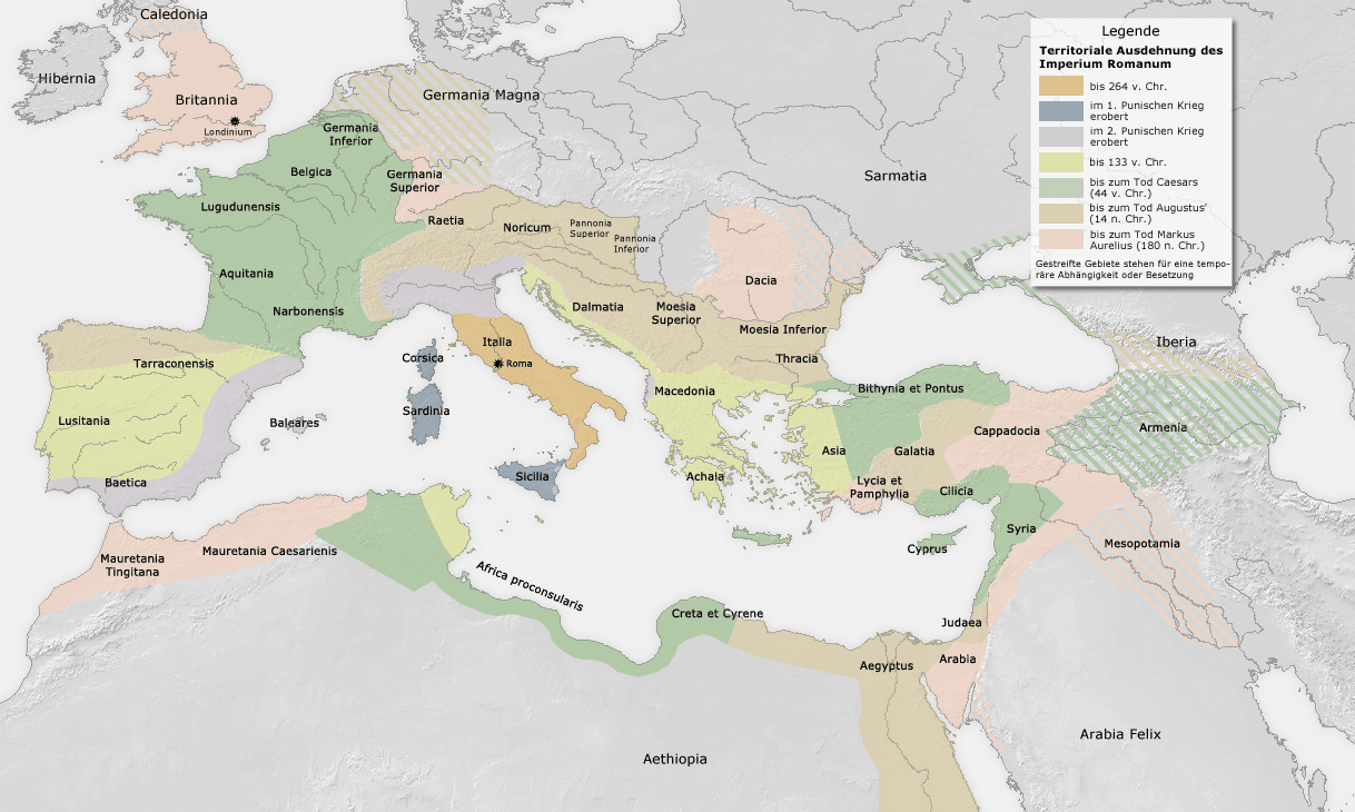
Karte ist erstellt von mir - Vorlage Demis http://www.demis.nl/wms/mapclip.htm archive copy at the Wayback Machine
Licensing
edit
This image is in the public domain because it came from the site https://www.demis.nl/products/web-map-server/examples/ and was released by the copyright holder. Permission is granted to copy, distribute and/or modify this map since it is based on free of copyright images from: www.demis.nl. See also approval email on de.wp and its clarification.
|
| This work has been released into the public domain by its copyright holder, www.demis.nl. This applies worldwide. In some countries this may not be legally possible; if so: www.demis.nl grants anyone the right to use this work for any purpose, without any conditions, unless such conditions are required by law.
|
File history
Click on a date/time to view the file as it appeared at that time.
| Date/Time | Thumbnail | Dimensions | User | Comment | |
|---|---|---|---|---|---|
| current | 12:58, 27 November 2005 | | 1,218 × 730 (256 KB) | FJ-de (talk | contribs) | Karte ist erstellt von mir - Vorlage Demis http://www.demis.nl/wms/mapclip.htm |
You cannot overwrite this file.
File usage on Commons
There are no pages that use this file.
File usage on other wikis
The following other wikis use this file:
- Usage on de.wikipedia.org