File:Australia Victoria LGAs by largest council faction.svg

Size of this PNG preview of this SVG file: 800 × 590 pixels. Other resolutions: 320 × 236 pixels | 640 × 472 pixels | 1,024 × 755 pixels | 1,280 × 944 pixels | 2,560 × 1,888 pixels | 1,749 × 1,290 pixels.
Original file (SVG file, nominally 1,749 × 1,290 pixels, file size: 1.14 MB)
Captions
Captions
Add a one-line explanation of what this file represents
Summary edit

|
This image is expected to always be the most recent one. Feel free to update it when needed.
|
| Description |
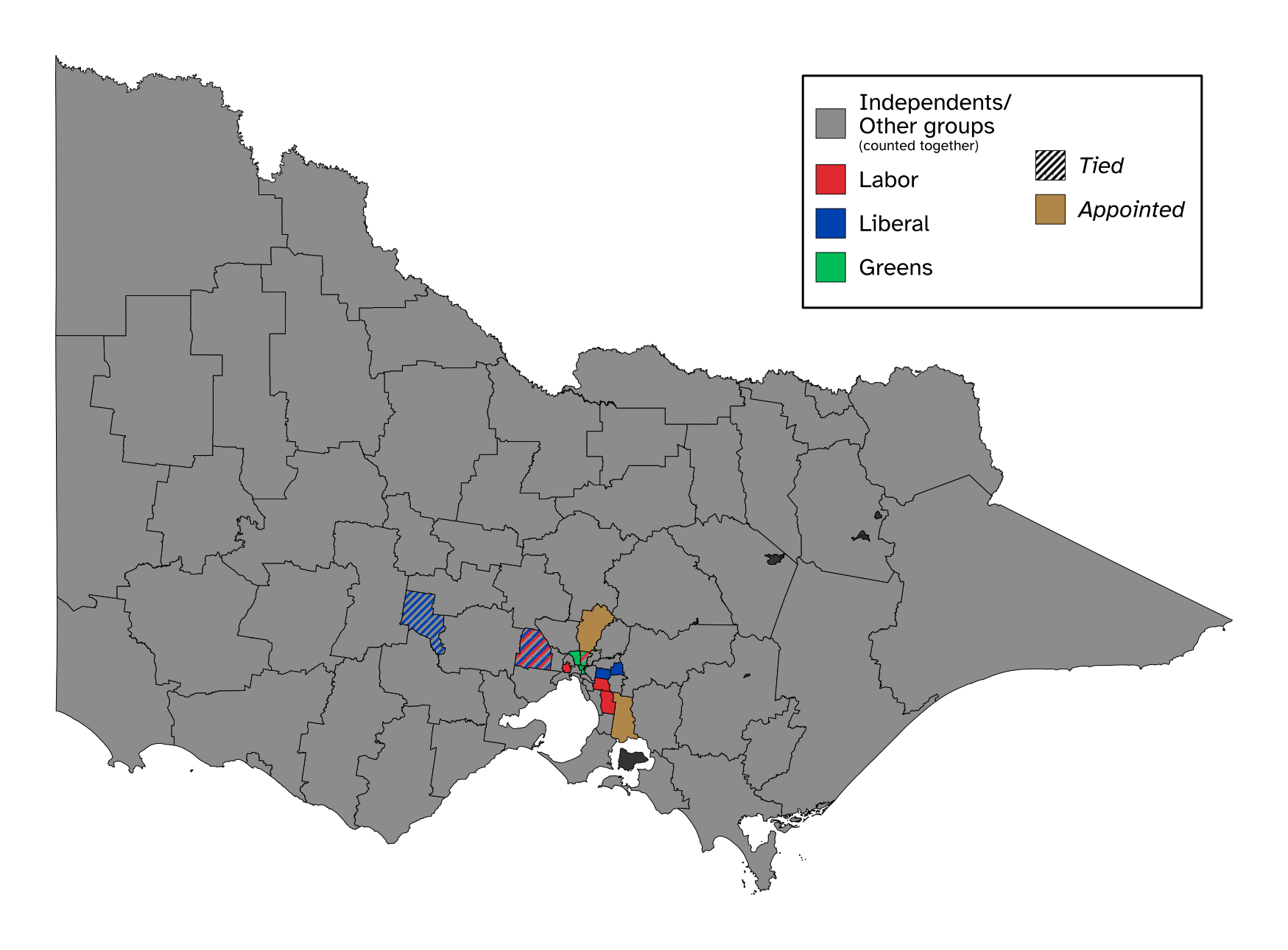
English: A map of local government areas in Victoria by the largest faction in each council, with grey for independents, red for Labor, blue for Liberal, and light green for the Greens. Shapefile from the Australian Bureau of Statistics, released under CC BY 4.0. |
| Date | |
| Source | Own work |
| Author | Twotwofourtysix |
Licensing edit
I, the copyright holder of this work, hereby publish it under the following license:
This file is licensed under the Creative Commons Attribution 4.0 International license.
- You are free:
- to share – to copy, distribute and transmit the work
- to remix – to adapt the work
- Under the following conditions:
- attribution – You must give appropriate credit, provide a link to the license, and indicate if changes were made. You may do so in any reasonable manner, but not in any way that suggests the licensor endorses you or your use.
File history
Click on a date/time to view the file as it appeared at that time.
| Date/Time | Thumbnail | Dimensions | User | Comment | |
|---|---|---|---|---|---|
| current | 11:40, 29 December 2022 | | 1,749 × 1,290 (1.14 MB) | Twotwofourtysix (talk | contribs) | Completes |
| 12:08, 27 December 2022 |  | 1,600 × 1,141 (587 KB) | Twotwofourtysix (talk | contribs) | More filled in | |
| 08:06, 27 December 2022 |  | 1,600 × 1,141 (587 KB) | Twotwofourtysix (talk | contribs) | Uploaded own work with UploadWizard |
You cannot overwrite this file.
File usage on Commons
There are no pages that use this file.
File usage on other wikis
The following other wikis use this file: