File:Australian local government areas.png
Size of this preview: 642 × 600 pixels. Other resolutions: 257 × 240 pixels | 514 × 480 pixels | 822 × 768 pixels | 1,096 × 1,024 pixels | 1,501 × 1,402 pixels.
Original file (1,501 × 1,402 pixels, file size: 339 KB, MIME type: image/png)
Captions
Captions
Add a one-line explanation of what this file represents
| Description |
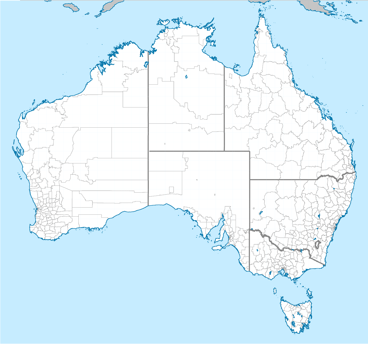
English: Map of Australian local government areas, created from data from the ABS.
|
||
| Source | Own work | ||
| Author | Cassowary |

File history
Click on a date/time to view the file as it appeared at that time.
| Date/Time | Thumbnail | Dimensions | User | Comment | |
|---|---|---|---|---|---|
| current | 20:48, 10 March 2011 | | 1,501 × 1,402 (339 KB) | Cassowary (talk | contribs) | {{Information |Description ={{en|1=Map of Australian local government areas, created from data from the ABS. {{gfdl|migration=not-eligible}}}} |Source ={{own}} |Author =Cassowary |Date = |Permission = | |
You cannot overwrite this file.
File usage on Commons
There are no pages that use this file.
File usage on other wikis
The following other wikis use this file:
- Usage on ar.wikipedia.org
- Usage on da.wikipedia.org
- Usage on de.wikipedia.org
- Usage on en.wikipedia.org
- Usage on eo.wikipedia.org
- Usage on es.wikipedia.org
- Usage on fi.wikipedia.org
- Usage on fr.wikipedia.org
- Usage on gl.wikipedia.org
- Usage on ja.wikipedia.org
- Usage on nl.wikipedia.org
- Usage on pl.wikipedia.org
- Usage on ru.wikipedia.org
- Usage on vi.wikipedia.org
- Usage on zh.wikipedia.org