File:Austrian-Empire map es.svg

Size of this PNG preview of this SVG file: 800 × 591 pixels. Other resolutions: 320 × 236 pixels | 640 × 473 pixels | 1,024 × 756 pixels | 1,280 × 945 pixels | 2,560 × 1,890 pixels | 818 × 604 pixels.
Original file (SVG file, nominally 818 × 604 pixels, file size: 416 KB)
Captions
Captions
Add a one-line explanation of what this file represents
Summary edit
| Description |
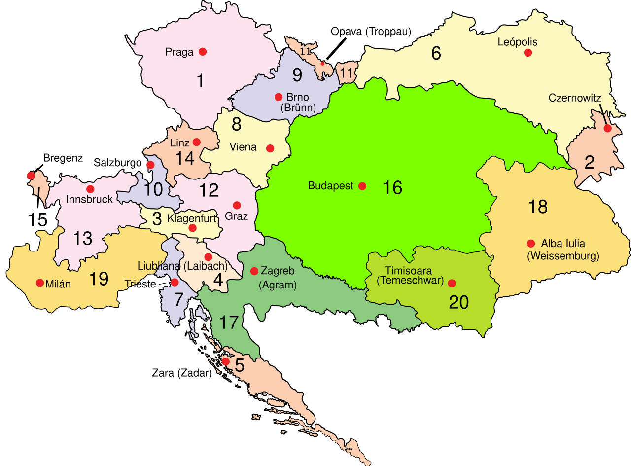
Español: Territorios del Imperio austríaco (1815-1867)': 1. Bohemia, 2. Bucovina, 3. Carintia, 4. Carniola, 5. Dalmacia, 6. Galicia, 7. Provincia costera 8. Baja Austria, 9. Moravia, 10. Salzburgo, 11. Silesia, 12. Estiria, 13. Tirol, 14. Alta Austria, 15. Vorarlberg, 16. Hungría 17. Croacia-Eslavonia, 18. Gran Principado de Transilvania, 19. Reino lombardo-véneto, 20.-Marca de la Voivodina y el Banato |
| Date | |
| Source |
This file was derived from: Austrian-Empire map fr.png |
| Author |
Austrian-Empire map fr.png: Spiridon Ion Cepleanu Austria-Hungary map ES.svg: rowanwindwhistler
|
Licensing edit
This file is licensed under the Creative Commons Attribution-Share Alike 3.0 Unported license.
- You are free:
- to share – to copy, distribute and transmit the work
- to remix – to adapt the work
- Under the following conditions:
- attribution – You must give appropriate credit, provide a link to the license, and indicate if changes were made. You may do so in any reasonable manner, but not in any way that suggests the licensor endorses you or your use.
- share alike – If you remix, transform, or build upon the material, you must distribute your contributions under the same or compatible license as the original.
File history
Click on a date/time to view the file as it appeared at that time.
| Date/Time | Thumbnail | Dimensions | User | Comment | |
|---|---|---|---|---|---|
| current | 18:57, 25 August 2021 | | 818 × 604 (416 KB) | Rowanwindwhistler (talk | contribs) | Uploaded a work by Spiridon Ion Cepleanu Rowanwindwhistler from https://commons.wikimedia.org/wiki/File:Austrian-Empire_map_fr.png https://commons.wikimedia.org/wiki/File:Austria-Hungary_map_ES.svg with UploadWizard |
You cannot overwrite this file.
File usage on Commons
The following page uses this file:
File usage on other wikis
The following other wikis use this file: