File:Auvaups-2015.svg

Size of this PNG preview of this SVG file: 507 × 553 pixels. Other resolutions: 220 × 240 pixels | 440 × 480 pixels | 704 × 768 pixels | 939 × 1,024 pixels | 1,878 × 2,048 pixels.
Original file (SVG file, nominally 507 × 553 pixels, file size: 101 KB)
Captions
Captions
Add a one-line explanation of what this file represents
Summary edit
| Description |
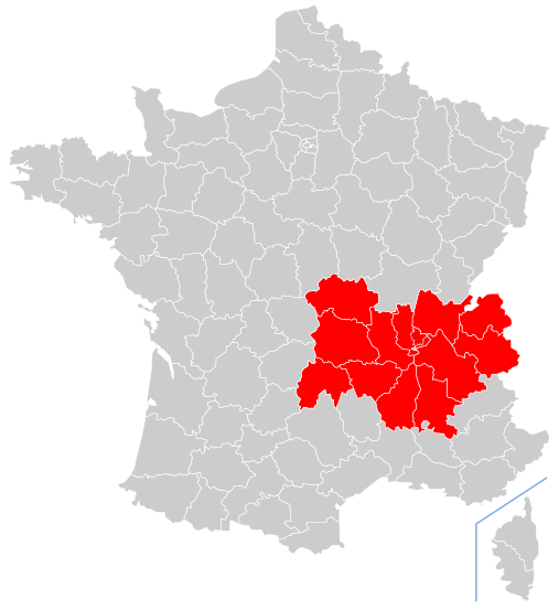
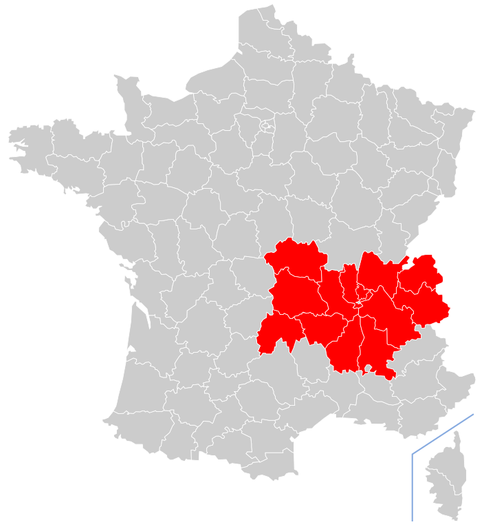
Occitan : La nòva region Auvèrnhe Ròse Aups |
| Date | |
| Source | Own work |
| Author | Jfblanc |
Licensing edit
I, the copyright holder of this work, hereby publish it under the following license:
This file is licensed under the Creative Commons Attribution-Share Alike 4.0 International license.
- You are free:
- to share – to copy, distribute and transmit the work
- to remix – to adapt the work
- Under the following conditions:
- attribution – You must give appropriate credit, provide a link to the license, and indicate if changes were made. You may do so in any reasonable manner, but not in any way that suggests the licensor endorses you or your use.
- share alike – If you remix, transform, or build upon the material, you must distribute your contributions under the same or compatible license as the original.
File history
Click on a date/time to view the file as it appeared at that time.
| Date/Time | Thumbnail | Dimensions | User | Comment | |
|---|---|---|---|---|---|
| current | 18:43, 28 November 2014 | | 507 × 553 (101 KB) | Jfblanc (talk | contribs) | User created page with UploadWizard |
You cannot overwrite this file.
File usage on Commons
The following 18 pages use this file:
- File:Auvergne-Rhône-Alpes region map (DPJ-2020).svg
- File:Bourgogne-Franche-Comté region map (DPJ-2020).svg
- File:Bretagne region map (DPJ-2020).svg
- File:Centre-Val de Loire region map (DPJ-2020).svg
- File:Corse region map (DPJ-2020).svg
- File:Grand Est region map (DPJ-2020).svg
- File:Guadeloupe region map (DPJ-2020).svg
- File:Guyane region map (DPJ-2020).svg
- File:Hauts-de-France region map (DPJ-2020).svg
- File:La Réunion region map (DPJ-2020).svg
- File:Martinique region map (DPJ-2020).svg
- File:Mayotte region map (DPJ-2020).svg
- File:Normandie region map (DPJ-2020).svg
- File:Nouvelle-Aquitaine region map (DPJ-2020).svg
- File:Occitanie region map (DPJ-2020).svg
- File:Pays de la Loire region map (DPJ-2020).svg
- File:Provence-Alpes-Côte d'Azur region map (DPJ-2020).svg
- File:Île-de-France region map (DPJ-2020).svg
.svg)
.svg)
.svg)
.svg)
.svg)
.svg)
.svg)
.svg)
.svg)
.svg)
.svg)
.svg)
.svg)
.svg)
.svg)
.svg)
.svg)
.svg)
File usage on other wikis
The following other wikis use this file:
- Usage on cy.wikipedia.org
- Usage on frp.wikipedia.org
- Usage on fr.wikipedia.org
- Politique en Rhône-Alpes
- Utilisateur:TouN/2
- Lac de Grand'Maison
- Portail:Allier/Portails connexes
- Portail:Allier
- Géographie de Rhône-Alpes
- Arôme au vin blanc
- Portail:Ain
- Portail:Ain/Portails connexes
- Portail:Saint-Étienne
- Projet:Saint-Étienne/Voir aussi
- Portail:Saint-Étienne/Articles
- Prix Gilbert-Dru
- Élections législatives de 2007 en Rhône-Alpes
- Chambre de commerce et d'industrie de l'Ain
- Utilisateur:Thomas42480
- Portail:Grenoble Métropole
- Portail:Drôme/Portails connexes
- Utilisateur:Beaufix
- Portail:Savoie/Section:Pied portail
- Chambre de commerce et d'industrie de Roanne Loire Nord
- Ligne de Belleville à Beaujeu
- Projet:Savoie/Portails connexes
- Portail:Isère
- Portail:Isère/Section:Divers
- Wikipédia:Liste de bandeaux d'ébauches de géographie/France
- Jacques Gérault
- M TAG
- Portail:Alpes
- Portail:Alpes/Section:Divers
- Unité urbaine de Lyon
- Utilisateur:Otourly/Infobox
- Portail:Annecy
- François Vernay
- Portail:Chambéry
- Portail:Chambéry/Section:Divers
- Portail:Annecy/Section:Divers
- Wikipédia:Crédits graphiques/Icônes de portails
- Utilisateur:Cyril de Rhône Alpes
- Portail:Grenoble Métropole/Section:Divers
- Ligne du Teil à Alès
- Gare de Tassin
- 12e étape du Tour de France 2010
- Portail:Massif du Jura
- Portail:Massif du Jura/Portails connexes
- Saison 2010-2011 du Club athlétique de Saint-Étienne Loire sud rugby
- Wikipédia:Boîtes utilisateur projets géographie
- Gare de Chazay - Marcilly
View more global usage of this file.