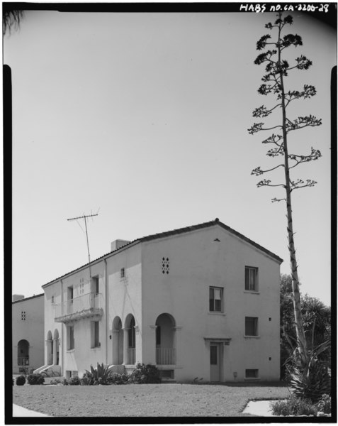
File:BLDG. -103; DOUBLE N.C.O. QUARTERS; EAST AND NORTH FACADES (4166-1) - Fort MacArthur, Pacific Avenue, San Pedro, Los Angeles County, CA HABS CAL,19-SANPE,2-28.tif

Original file(3,957 × 4,973 pixels, file size: 18.77 MB, MIME type: image/tiff)

Captions

Captions

Add a one-line explanation of what this file represents

Summary edit

BLDG. -103; DOUBLE N.C.O. QUARTERS; EAST AND NORTH FACADES (4166-1) - Fort MacArthur, Pacific Avenue, San Pedro, Los Angeles County, CA
Photographer

Related names:

Office of the Quartermaster General, U.S. Army
Construction Division, Office of Quartermaster General
Title
BLDG. -103; DOUBLE N.C.O. QUARTERS; EAST AND NORTH FACADES (4166-1) - Fort MacArthur, Pacific Avenue, San Pedro, Los Angeles County, CA
Depicted place California; Los Angeles County; San Pedro
Date Documentation compiled after 1933
Dimensions 4 x 5 in.
Current location
Library of Congress Prints and Photographs Division Washington, D.C. 20540 USA http://hdl.loc.gov/loc.pnp/pp.print
Accession number
HABS CAL,19-SANPE,2-28
Credit line
This file comes from the Historic American Buildings Survey (HABS), Historic American Engineering Record (HAER) or Historic American Landscapes Survey (HALS). These are programs of the National Park Service established for the purpose of documenting historic places. Records consist of measured drawings, archival photographs, and written reports.

This tag does not indicate the copyright status of the attached work. A normal copyright tag is still required. See Commons:Licensing.

Notes
  • Significance: In 1846 the Mexican governor of Alta California, Pio Pico, directed that a 500 varas square of land facing onto San Pedro Bay be set aside as a government reservation (approximately 44.25 acres). The same boundaries of the original Mexican government reservation were recognized and affirmed by the United States Federal government after the American acquisition of California. In 1888 President Grover Cleveland established the 500 Varas Square as a military reservation. With the advent of America's entrance into the First World War, permanent buildings (housing) were added. Twenty-seven of these permanent buildings dating from two construction periods, the first dating from 1916-18 and the second from 1933-34, remain basically intact. These buildings are architecturally significant as a representation of an institutional application of the then-popular Mission Revival and California Bungalow or Arts and Crafts Styles. The building form two ensembles; one grouped around the Patton Quadrangle and the second gathered around the Parade Ground. Their stature as ensembles is intensified due to their group orientation around these two large open spaces. These buildings are: Bldg. 30-Administration Building, 1916-18; Bldg. 31-Mess Hall; Post Chapel, 1916-18; Bldg. 32-Post Exchange and Gymnasium, 1916-18; Bldg. 41-Guard House and Fire Station, 1916-18; Bldgs. 33, 36, 37, & 40-Company Barracks Buildings, 1916-18; Bldg. 11-Three-family Officers' Quarters, 1916-18; Bldgs. 3, 7, 9, & 10-Double Officers' Quarters, 1916-18; Bldgs. 1 & 5-Single Officers' Quarters, 1916-18; Bldgs. 51, 53, 55, 102, 103, 104, & 105-Double N.C.O. Quarters, 1933-34; Bldg. 50-Three-set N.C.O. Quarters, 1914; 1916-18; Bldgs. 52 & 54-Two-set N.C.O. Quarters, 1916-18; Bldg. 60-Bakery Building, 1916-18; Bldg. 93-Bachelor Officers' Quarters, 1916-18.
  • Unprocessed Field note material exists for this structure: FN-232
  • Survey number: HABS CA-2206
  • Building/structure dates: ca. 1918 Initial Construction
  • Building/structure dates: ca. 1934 Subsequent Work
Source https://www.loc.gov/pictures/item/ca1383.photos.012826p
Permission
(Reusing this file)
Public domain This image or media file contains material based on a work of a National Park Service employee, created as part of that person's official duties. As a work of the U.S. federal government, such work is in the public domain in the United States. See the NPS website and NPS copyright policy for more information.
Object location33° 44′ 08.99″ N, 118° 17′ 29″ W Kartographer map based on OpenStreetMap.View this and other nearby images on: OpenStreetMapinfo

File history

Click on a date/time to view the file as it appeared at that time.

Date/TimeThumbnailDimensionsUserComment
current04:02, 3 July 2014Thumbnail for version as of 04:02, 3 July 20143,957 × 4,973 (18.77 MB) (talk | contribs)GWToolset: Creating mediafile for Fæ. HABS batch upload 2 July 2014 (301:400)

Metadata