File:Bade 1806 1945.png

Size of this preview: 406 × 599 pixels. Other resolutions: 163 × 240 pixels | 325 × 480 pixels | 520 × 768 pixels | 694 × 1,024 pixels | 1,952 × 2,880 pixels.
Original file (1,952 × 2,880 pixels, file size: 328 KB, MIME type: image/png)
Captions
Captions
Add a one-line explanation of what this file represents
Summary edit
| Description |
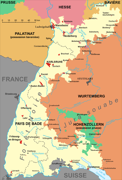
Deutsch: Karte von Baden von 1806 bis 1945: Großherzogtum Baden (1806–1918); Republik Baden (1918–1945).
English: Map of Baden (Germany) from 1806 to 1945: Grand Duchy of Baden (1806–1918); Republic of Baden (1918–1945).
Español: Baden desde 1806 a 1945.
Français : Carte du Bade (Allemagne) de 1806 à 1945: Grand-duché de Bade (1806–1918); République de Bade (1918–1945). |
| Date | |
| Source | Own work based on: File:Map of Baden (1806-1945).png |
| Author |
Deutsch: Übersetzt, vervollständigt und neu koloriert von Eric Gaba (User:Sting).
English: Translation, new information and colours by Eric Gaba (User:Sting).
Français : Traduite, complétée et recolorée par Eric Gaba (fr:Utilisateur:Sting). |
.png)
Licensing edit
| This work has been released into the public domain by its author, Störfix. This applies worldwide. In some countries this may not be legally possible; if so: |
File history
Click on a date/time to view the file as it appeared at that time.
| Date/Time | Thumbnail | Dimensions | User | Comment | |
|---|---|---|---|---|---|
| current | 19:43, 15 February 2006 | | 1,952 × 2,880 (328 KB) | Sting (talk | contribs) | {{en}} * '''Subject :''' Map of the Grand Duchy of Baden (Germany), from 1806 to 1945 ( with French caption) ; * '''Source :''' Image:Karte-Baden.png made by de:Benutzer:Störfix ; * '''This version :''' Translation, new information and colours |
You cannot overwrite this file.
File usage on Commons
The following 2 pages use this file:
File usage on other wikis
The following other wikis use this file:
- Usage on es.wikipedia.org
- Usage on fr.wikipedia.org
- Usage on fr.wiktionary.org
- Usage on pt.wikipedia.org
- Usage on ro.wikipedia.org