File:Baie Burrard carte avec toponymes en francais.svg

Original file (SVG file, nominally 1,273 × 918 pixels, file size: 92 KB)
Captions
Captions
Summary edit
| Description |
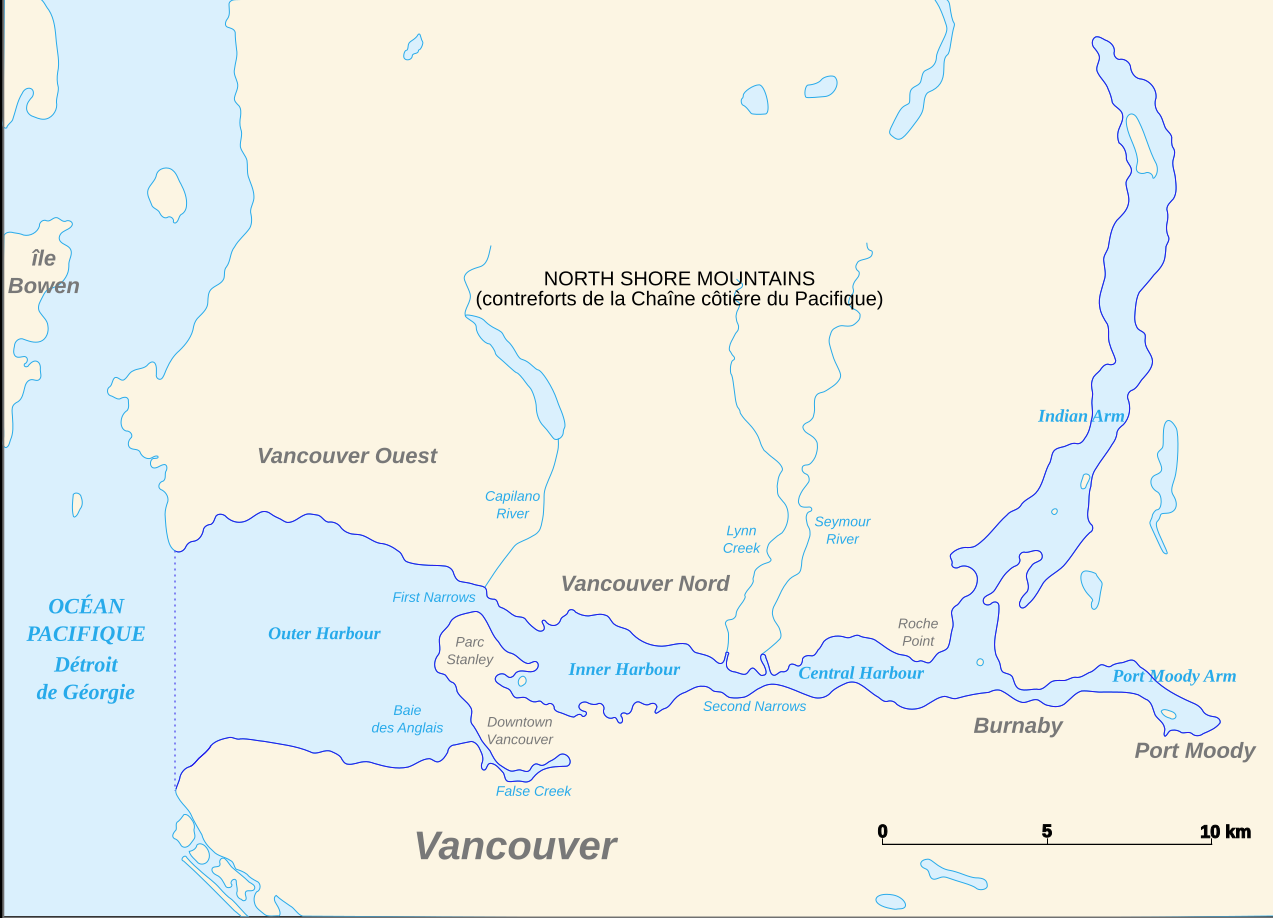
Carte de la baie Burrard au Nord de Vancouver en Colombie-Britannique au Canada, avec quelques toponymes dont certains traduits en français. Données du contour des rivages obtenues sur le site FTP de SWBD (SRTM Water Body Dataset) du SRTM (Shuttle Radar Topography Mission) de la NASA. Visualisation des contours sur le logiciel dlgv32 Pro (version allégée de Global Mapper 9) de l'USGS. Projection UTM. Image vectorisée sous Inkscape. Format SVG. Nota : Les trois cours d'eau ont été ajoutés à la main à partir d'une vue de Google Maps. Carte réalisée en s'appuyant sur le didactiel de Sting |
| Date | |
| Source | Own work |
| Author | Arct |
| Other versions | Derivative works of this file: Burrard-Inlet-map-en.svg |
Licensing edit

|
Permission is granted to copy, distribute and/or modify this document under the terms of the GNU Free Documentation License, Version 1.2 or any later version published by the Free Software Foundation; with no Invariant Sections, no Front-Cover Texts, and no Back-Cover Texts. A copy of the license is included in the section entitled GNU Free Documentation License. |
- You are free:
- to share – to copy, distribute and transmit the work
- to remix – to adapt the work
- Under the following conditions:
- attribution – You must give appropriate credit, provide a link to the license, and indicate if changes were made. You may do so in any reasonable manner, but not in any way that suggests the licensor endorses you or your use.
- share alike – If you remix, transform, or build upon the material, you must distribute your contributions under the same or compatible license as the original.

|
This SVG file contains embedded text that can be translated into your language, using any capable SVG editor, text editor or the SVG Translate tool. For more information see: About translating SVG files. |
File history
Click on a date/time to view the file as it appeared at that time.
| Date/Time | Thumbnail | Dimensions | User | Comment | |
|---|---|---|---|---|---|
| current | 22:48, 22 November 2007 | | 1,273 × 918 (92 KB) | Arct (talk | contribs) | |
| 22:05, 21 November 2007 |  | 1,273 × 918 (70 KB) | Arct (talk | contribs) | Carte de la baie Burrard au Nord de Vancouver en Colombie-Britannique au Canada, avec quelques toponymes dont certains traduits en français. Données du contour des rivages obtenues sur le [ftp://e0srp01u.ecs.nasa.gov/srtm/version2/SWBD site FTP] de [ht | |
| 01:20, 21 November 2007 |  | 1,273 × 918 (70 KB) | Arct (talk | contribs) | ||
| 01:19, 21 November 2007 |  | 1,273 × 918 (67 KB) | Arct (talk | contribs) | ||
| 23:52, 20 November 2007 |  | 1,273 × 918 (65 KB) | Arct (talk | contribs) | {{Information |Description=Carte de la baie Burrard au Nord de Vancouver en Colombie-Britannique au Canada, avec quelques toponymes dont certains traduits en français. Données du contour des rivages obtenues sur le [ftp://e0srp01u.ecs.nasa.gov/srtm/vers |
You cannot overwrite this file.
File usage on Commons
The following 2 pages use this file:
File usage on other wikis
The following other wikis use this file:
- Usage on fr.wikipedia.org