File:Bali sund och öar.png
Size of this preview: 731 × 599 pixels. Other resolutions: 293 × 240 pixels | 586 × 480 pixels | 937 × 768 pixels | 1,249 × 1,024 pixels | 2,104 × 1,725 pixels.
Original file (2,104 × 1,725 pixels, file size: 2.13 MB, MIME type: image/png)
Captions
Captions
Add a one-line explanation of what this file represents
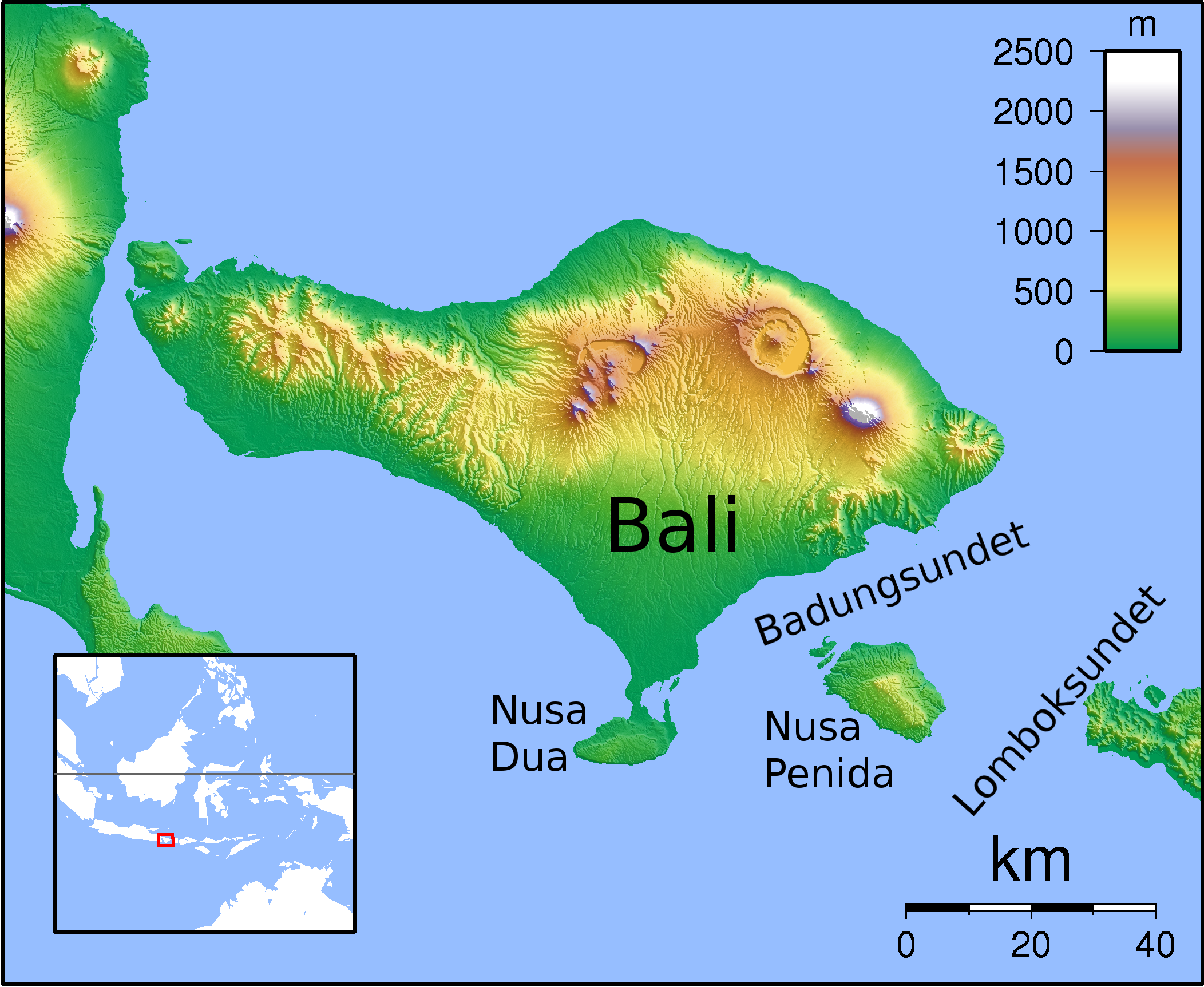
| Description | Location map for Bali. Created with GMT from SRTM data. Left: 114.25, Right: 116, Top:-7.75, Bottom:-9.1666666 |
| Date | (UTC) |
| Source | |
| Author |
|
| This is a retouched picture, which means that it has been digitally altered from its original version. Modifications: Added Swedish names. The original can be viewed here: Bali Locator Topography.png:
|
I, the copyright holder of this work, hereby publish it under the following licenses:
This file is licensed under the Creative Commons Attribution-Share Alike 3.0 Unported license.
- You are free:
- to share – to copy, distribute and transmit the work
- to remix – to adapt the work
- Under the following conditions:
- attribution – You must give appropriate credit, provide a link to the license, and indicate if changes were made. You may do so in any reasonable manner, but not in any way that suggests the licensor endorses you or your use.
- share alike – If you remix, transform, or build upon the material, you must distribute your contributions under the same or compatible license as the original.

|
Permission is granted to copy, distribute and/or modify this document under the terms of the GNU Free Documentation License, Version 1.2 or any later version published by the Free Software Foundation; with no Invariant Sections, no Front-Cover Texts, and no Back-Cover Texts. A copy of the license is included in the section entitled GNU Free Documentation License. |
You may select the license of your choice.
Original upload log edit
This image is a derivative work of the following images:
- File:Bali_Locator_Topography.png licensed with Cc-by-sa-3.0, GFDL
- 2009-03-01T16:57:33Z Sadalmelik 2104x1725 (1921920 Bytes) {{Information |Description=Location map for Bali. Created with GMT from SRTM data. Left: 114.25, Right: 116, Top:-7.75, Bottom:-9.1666666 |Source=Own work by uploader |Date=2009-03-01 |Author=[[User:Sadalmelik|Sadalmelik]] |P
Uploaded with derivativeFX
File history
Click on a date/time to view the file as it appeared at that time.
| Date/Time | Thumbnail | Dimensions | User | Comment | |
|---|---|---|---|---|---|
| current | 01:33, 14 March 2010 | | 2,104 × 1,725 (2.13 MB) | Rotsee (talk | contribs) | {{Information |Description=Location map for Bali. Created with GMT from SRTM data. Left: 114.25, Right: 116, Top:-7.75, Bottom:-9.1666666 |Source=*File:Bali_Locator_Topography.png |Date=2010-03-14 01:32 (UTC) |Author=*[[:File:Bali_Locator_Topography |
You cannot overwrite this file.
File usage on Commons
There are no pages that use this file.
File usage on other wikis
The following other wikis use this file:
- Usage on he.wikipedia.org
- Usage on nn.wikipedia.org
- Usage on no.wikipedia.org
- Usage on sv.wikipedia.org