File:Basislinie Nordfriesland.svg

Size of this PNG preview of this SVG file: 542 × 599 pixels. Other resolutions: 217 × 240 pixels | 434 × 480 pixels | 695 × 768 pixels | 926 × 1,024 pixels | 1,853 × 2,048 pixels | 1,026 × 1,134 pixels.
Original file (SVG file, nominally 1,026 × 1,134 pixels, file size: 176 KB)
Captions
Captions
Add a one-line explanation of what this file represents
Summary edit
| Description |
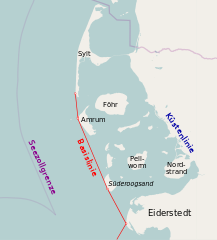
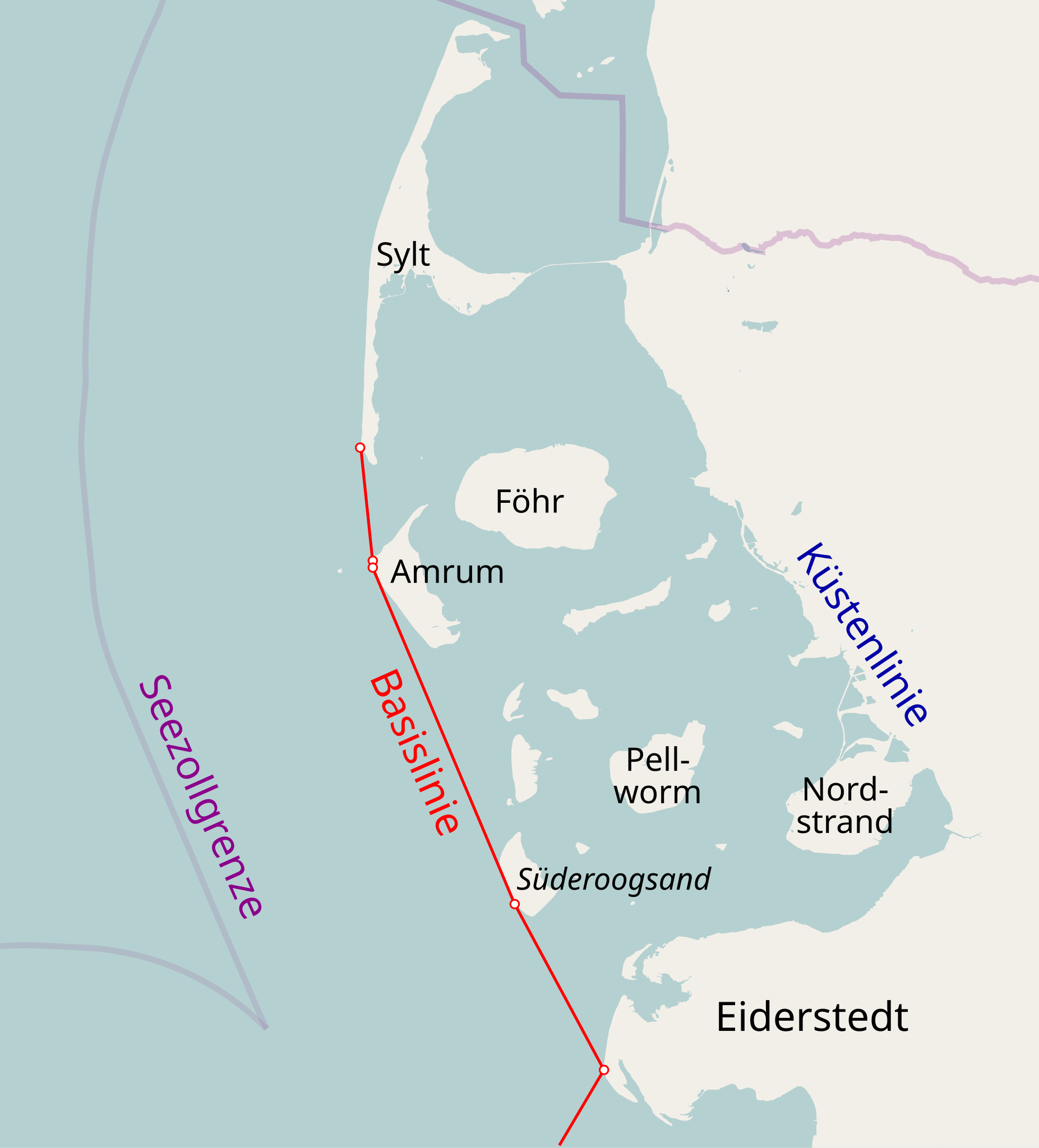
Deutsch: Basislinie in Nordfriesland
English: Baseline in North Frisia |
| Date | |
| Source | own work, using Open Street Map |
| Author | OpenStreetMap contributors and NordNordWest |
| Permission (Reusing this file) |
This file is licensed under the Creative Commons Attribution-Share Alike 2.0 Generic license.
|
File history
Click on a date/time to view the file as it appeared at that time.
| Date/Time | Thumbnail | Dimensions | User | Comment | |
|---|---|---|---|---|---|
| current | 17:28, 21 April 2009 | | 1,026 × 1,134 (176 KB) | NordNordWest (talk | contribs) | ergänzt |
| 20:24, 16 April 2009 |  | 1,026 × 1,134 (167 KB) | NordNordWest (talk | contribs) | {{Information |Description= {{de|Basislinie in Nordfriesland}} {{en|Baseline in North Frisia}} |Source=own work, using Open Street Map |Date=16-04-2009 |Author=OpenStreetMap contributors and [[User:Nord |
You cannot overwrite this file.
File usage on Commons
The following page uses this file:
File usage on other wikis
The following other wikis use this file:
- Usage on de.wikipedia.org