File:Baton Rouge Port Allen Map Louisiana 1963.jpg
Size of this preview: 498 × 599 pixels. Other resolutions: 199 × 240 pixels | 399 × 480 pixels | 638 × 768 pixels | 851 × 1,024 pixels | 1,702 × 2,048 pixels | 3,740 × 4,500 pixels.
Original file (3,740 × 4,500 pixels, file size: 4.56 MB, MIME type: image/jpeg)
Captions
Captions
Add a one-line explanation of what this file represents
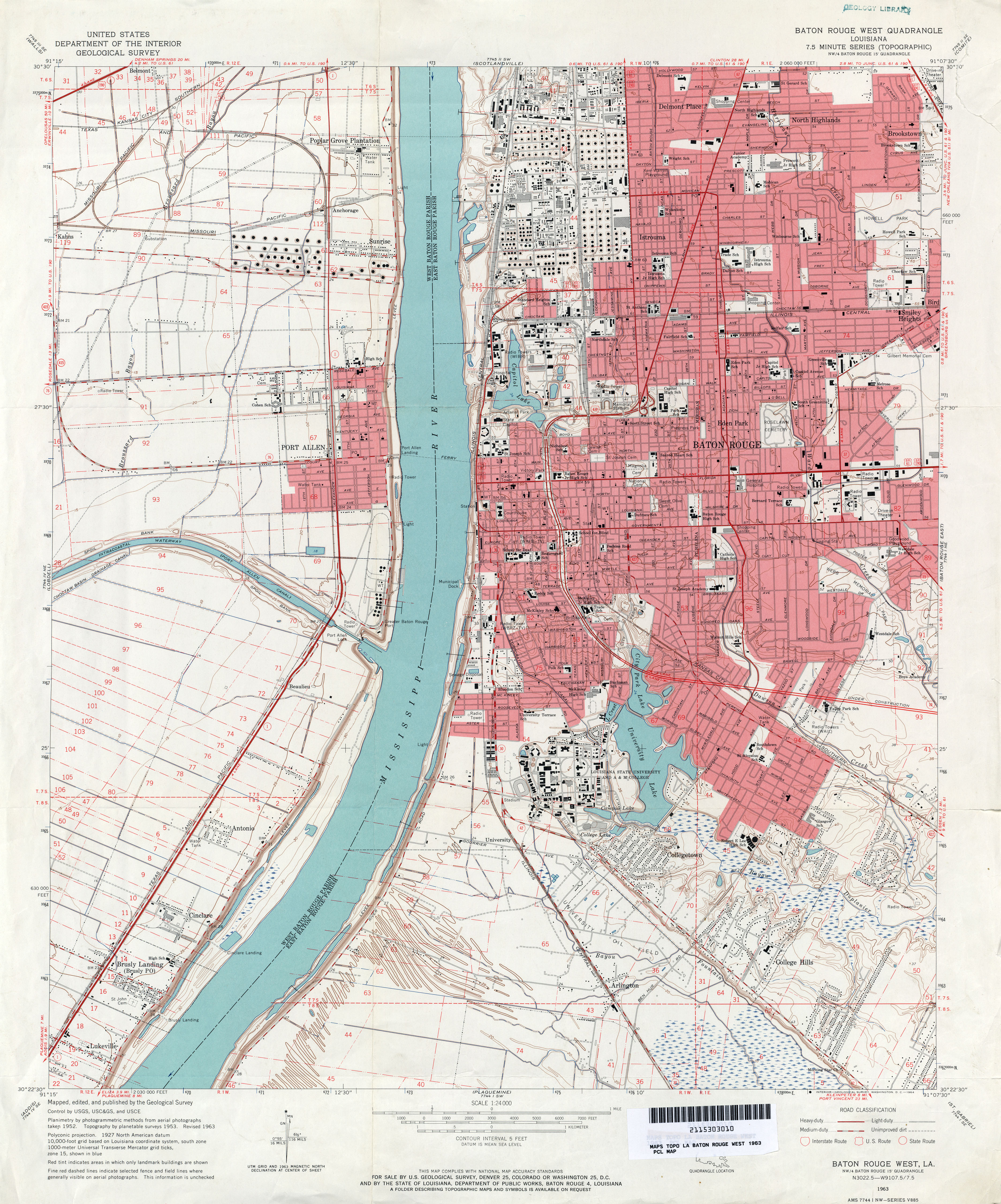
| Description | 1963 map of section of central Baton Rouge, Louisiana, and Port Allen across the Mississippi River. | |||
| Date | ||||
| Source | U.S. Geological Survey map, 1963 via [1] | |||
| Author | U.S. Geological Survey | |||
| Permission (Reusing this file) |
|
File history
Click on a date/time to view the file as it appeared at that time.
| Date/Time | Thumbnail | Dimensions | User | Comment | |
|---|---|---|---|---|---|
| current | 00:21, 20 June 2012 | | 3,740 × 4,500 (4.56 MB) | Infrogmation (talk | contribs) | {{Information |Description= 1963 map of section of central Baton Rouge, Louisiana, and Port Allen across the Mississippi River. |Source= U.S. Geological Survey map, 1963 via [http://www.lib.utexas.edu/maps/topo/louisiana/] |Date=1963 |Author=U.S. Geo... |
You cannot overwrite this file.
File usage on Commons
There are no pages that use this file.