File:Battery Rock from Caseyville.jpg

Size of this preview: 800 × 450 pixels. Other resolutions: 320 × 180 pixels | 640 × 360 pixels | 1,024 × 576 pixels | 1,280 × 720 pixels | 2,816 × 1,584 pixels.
Original file (2,816 × 1,584 pixels, file size: 1.32 MB, MIME type: image/jpeg)
Captions
Captions
Add a one-line explanation of what this file represents
|
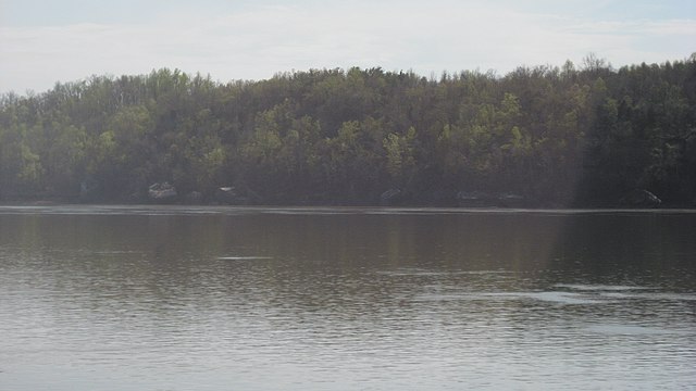
This is an image of a place or building that is listed on the National Register of Historic Places in the United States of America. Its reference number is 98001257. |
| Camera location | | View this and other nearby images on: OpenStreetMap |
|---|
| Description |
English: Looking across the Ohio River from the public landing at Caseyville, Kentucky, United States. On the other side is an old landing known as Battery Rock, which is listed on the National Register of Historic Places. |
||
| Date | Taken on 13 April 2013 | ||
| Source | Own work | ||
| Author | Nyttend | ||
| Permission (Reusing this file) |
|
| Annotations | This image is annotated: View the annotations at Commons |

File history
Click on a date/time to view the file as it appeared at that time.
| Date/Time | Thumbnail | Dimensions | User | Comment | |
|---|---|---|---|---|---|
| current | 02:26, 19 April 2013 | | 2,816 × 1,584 (1.32 MB) | Nyttend (talk | contribs) | {{NRHP|98001257}} {{Location|37|32|5|N|88|4|10|W}} {{Information |Description={{en|Looking across the {{w|Ohio River}} from the public landing at {{w|Caseyville, Kentucky|Caseyville}}, {{w|Kentucky}}, {{w|United States}}. On the other side is an old l... |
You cannot overwrite this file.
File usage on Commons
The following page uses this file:
File usage on other wikis
The following other wikis use this file:
- Usage on ceb.wikipedia.org
- Usage on www.wikidata.org