File:BattleOfChantillyMap.jpg
Original file (4,016 × 3,118 pixels, file size: 1.8 MB, MIME type: image/jpeg)
Captions
Captions
Summary edit
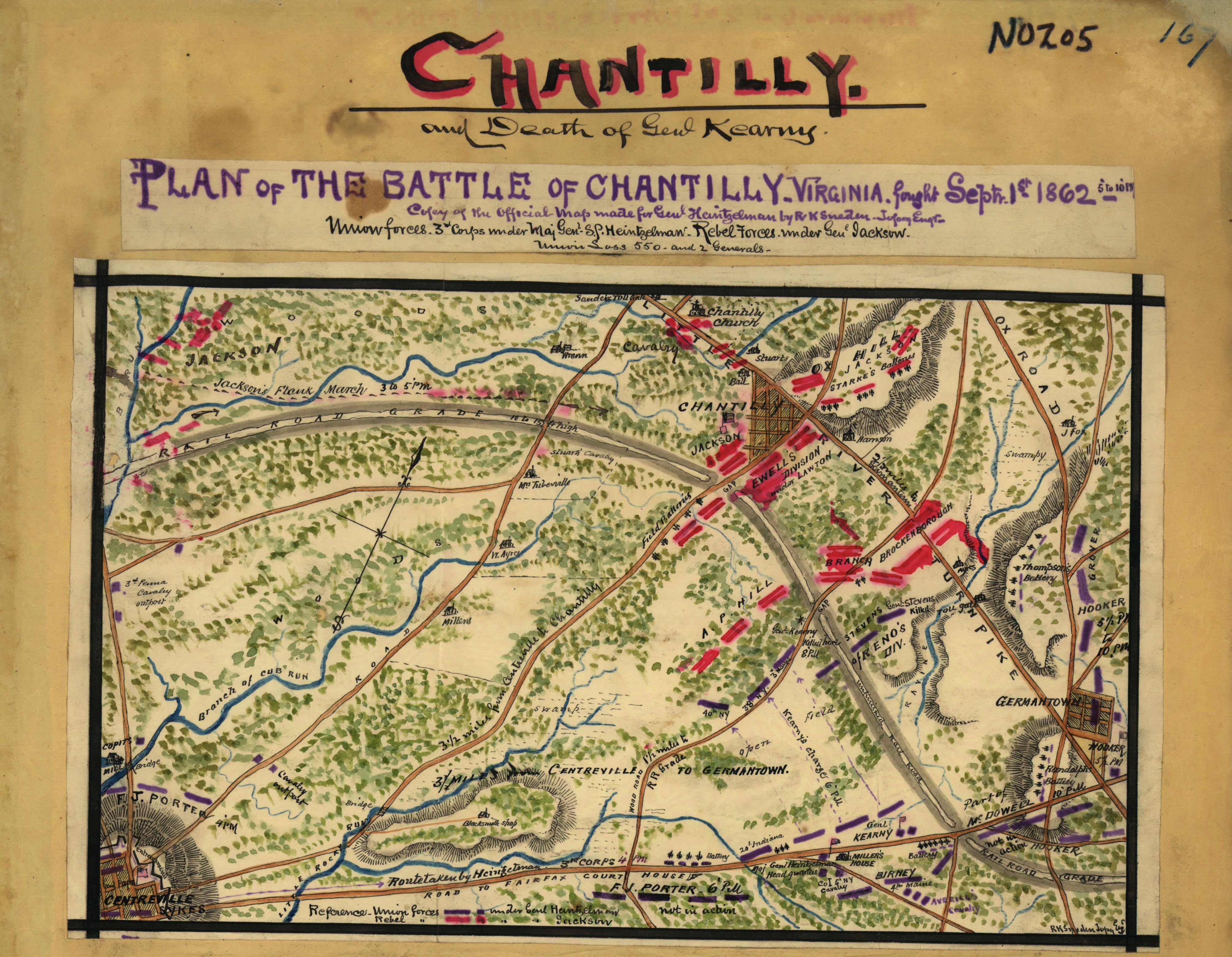
| Description | Map of the Battle of Chantilly (also known as the Battle of Ox Hill) on September 1, 1862, depicting events from 5 to 10 PM. | |||||||||||||||||||||||
| Date | between circa 1862 and circa 1865 | |||||||||||||||||||||||
| Source |
Part of a scrapbook owned by the Virginia Historical Society, and displayed by the U.S. Library of Congress.
|
|||||||||||||||||||||||
| Author |
|
|||||||||||||||||||||||
| Permission (Reusing this file) |
|
|||||||||||||||||||||||


Licensing edit
This image is a work of a U.S. military or Department of Defense employee, taken or made as part of that person's official duties. As a work of the U.S. federal government, the image is in the public domain in the United States.
|
 |
File history
Click on a date/time to view the file as it appeared at that time.
| Date/Time | Thumbnail | Dimensions | User | Comment | |
|---|---|---|---|---|---|
| current | 03:27, 23 October 2006 | | 4,016 × 3,118 (1.8 MB) | Clindberg (talk | contribs) | Map of the Battle of Chantilly (also known as the Battle of Ox Hill) on September 1, 1861, depicting events from 5 to 10 PM. Map drawn by Robert Knox Sneden (1832 - 1918). Part of a scrapbook owned by the Virginia Historical Society, and [http://hdl.loc |
You cannot overwrite this file.
File usage on Commons
There are no pages that use this file.
File usage on other wikis
The following other wikis use this file:
- Usage on en.wikipedia.org
- Usage on fr.wikipedia.org
- Usage on ja.wikipedia.org
- Usage on nl.wikipedia.org
- Usage on no.wikipedia.org
- Usage on pl.wikipedia.org