File:BattleOfNewOrleansAreaMap.jpg
Size of this preview: 604 × 599 pixels. Other resolutions: 242 × 240 pixels | 484 × 480 pixels | 774 × 768 pixels | 1,100 × 1,091 pixels.
Original file (1,100 × 1,091 pixels, file size: 294 KB, MIME type: image/jpeg)
Captions
Captions
Add a one-line explanation of what this file represents
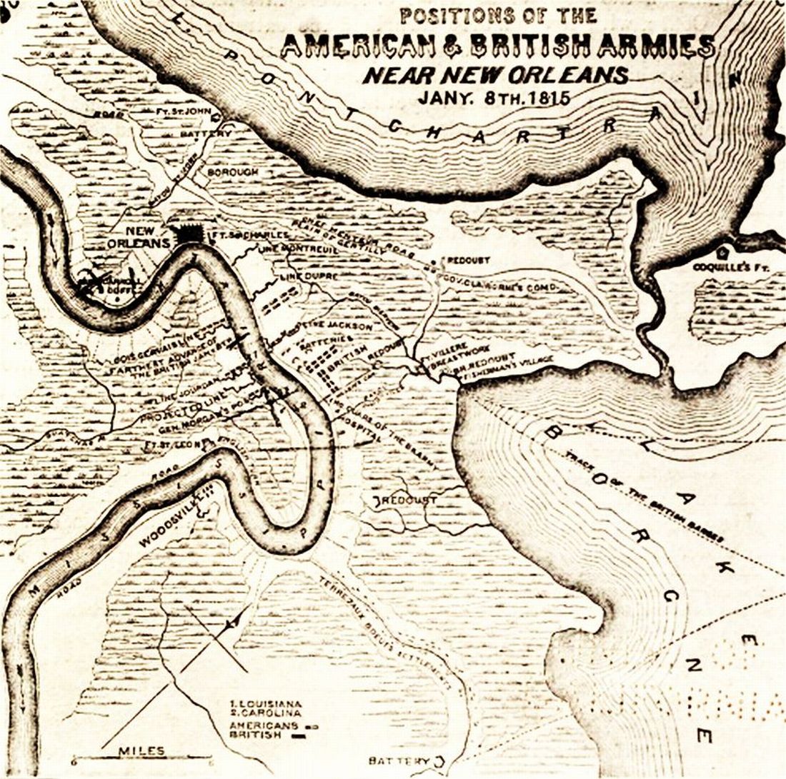
| Description | Map "Position of the American and British Armies near New Orleans on the 8th of January, 1815". Shows area of South East Louisiana where battles and skirmishes took place between U.S. and British forces during December 1814 and January 1815 in the "War of 1812". Visible details include the positions of the city of New Orleans, Chalmette Battlefield, Fort Coquille, Chef Menteur Road, bends of the Mississippi River into Plaquemines, and portions of the shores of Lakes Pontchartrain and Borgne. | ||||||
| Date | See notes on source above. Published 1904; depicting events of 1815; actual date map was drawn or engraved not known. | ||||||
| Source | Old map, via printing in book "The Battle of New Orleans, including the Previous Engagements between the Americans and the British, the Indians and the Spanish which led to the Final Conflict on the 8th of January, 1815" by Zachary F. Smith, published by John P. Morton & Company, printers to the Filson Club, Louisville, Kentucky, 1904. Via copy online at [1]. Note: From appearance and other illustrations in this book, this was likely not the original appearance of this map; it was likely a 19th century work already public domain when the book was printed. | ||||||
| Author | Map maker not credited | ||||||
| Permission (Reusing this file) |
|


File history
Click on a date/time to view the file as it appeared at that time.
| Date/Time | Thumbnail | Dimensions | User | Comment | |
|---|---|---|---|---|---|
| current | 11:17, 26 October 2009 | | 1,100 × 1,091 (294 KB) | Infrogmation (talk | contribs) | {{Information |Description= Map "Position of the American and British Armies near New Orleans on the 8th of January, 1815". Shows area of South East Louisiana where battles and skirmishes took place between U.S. and British forces during December 1814 a |
You cannot overwrite this file.
File usage on Commons
There are no pages that use this file.
File usage on other wikis
The following other wikis use this file:
- Usage on en.wikipedia.org
- Usage on simple.wikipedia.org