File:Battle of Gallipoli - Turkish map of Cape Helles to Krithia.png

Size of this preview: 800 × 586 pixels. Other resolutions: 320 × 234 pixels | 640 × 468 pixels | 1,024 × 749 pixels | 1,280 × 937 pixels | 2,560 × 1,874 pixels | 5,222 × 3,822 pixels.
Original file (5,222 × 3,822 pixels, file size: 31.33 MB, MIME type: image/png)
Captions
Captions
Add a one-line explanation of what this file represents

| Description |
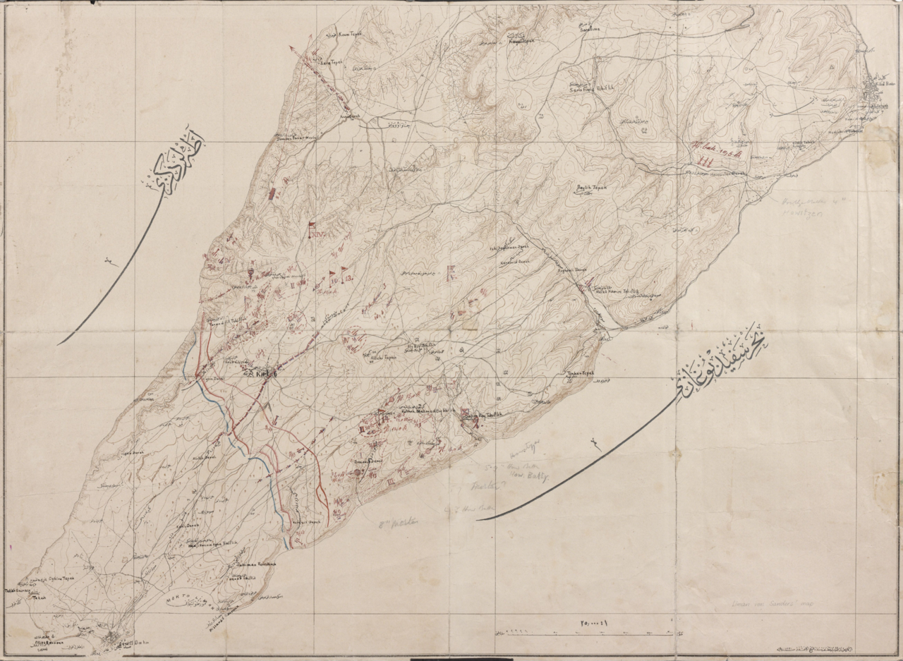
English: This map covers southern Gallipoli, from Cape Helles to Krithia. On the back is written “ Dardanelles … Sommer 1915 Liman v Sanders”. The map is annotated, showing allied and Turkish front lines, and the disposition of Turkish forces during the summer of 1915 (June to August). The annotations on the map show the positions of the 1st, 10th, 13th and 14th Divisions, and the position of the Second Army headquarters in early August 1915, around the time of the allied assaults in August. |
|||
| Date | ||||
| Source |
Australian War Memorial reference code: G7432.G1 S65 XII.8e url: http://www.awm.gov.au/exhibitions/gmaps/turkish/helles.asp |
|||
| Author | Turkish Mapping Directorate | |||
| Permission (Reusing this file) |
|
.svg)
File history
Click on a date/time to view the file as it appeared at that time.
| Date/Time | Thumbnail | Dimensions | User | Comment | |
|---|---|---|---|---|---|
| current | 13:27, 21 June 2011 | | 5,222 × 3,822 (31.33 MB) | Labattblueboy (talk | contribs) | {{PNG with JPEG version|Battle of Gallipoli - Turkish map of Cape Helles to Krithia.jpg}} {{Information |Description={{en|This map covers southern Gallipoli, from Cape Helles to Krithia. On the back is written “ Dardanelles … Sommer 1915 Liman v Sande |
You cannot overwrite this file.
File usage on Commons
The following page uses this file: