File:Bayou Teche and Atchafalaya River.jpg
Size of this preview: 399 × 599 pixels. Other resolutions: 160 × 240 pixels | 320 × 480 pixels | 999 × 1,500 pixels.
Original file (999 × 1,500 pixels, file size: 213 KB, MIME type: image/jpeg)
Captions
Captions
Add a one-line explanation of what this file represents
| Description |
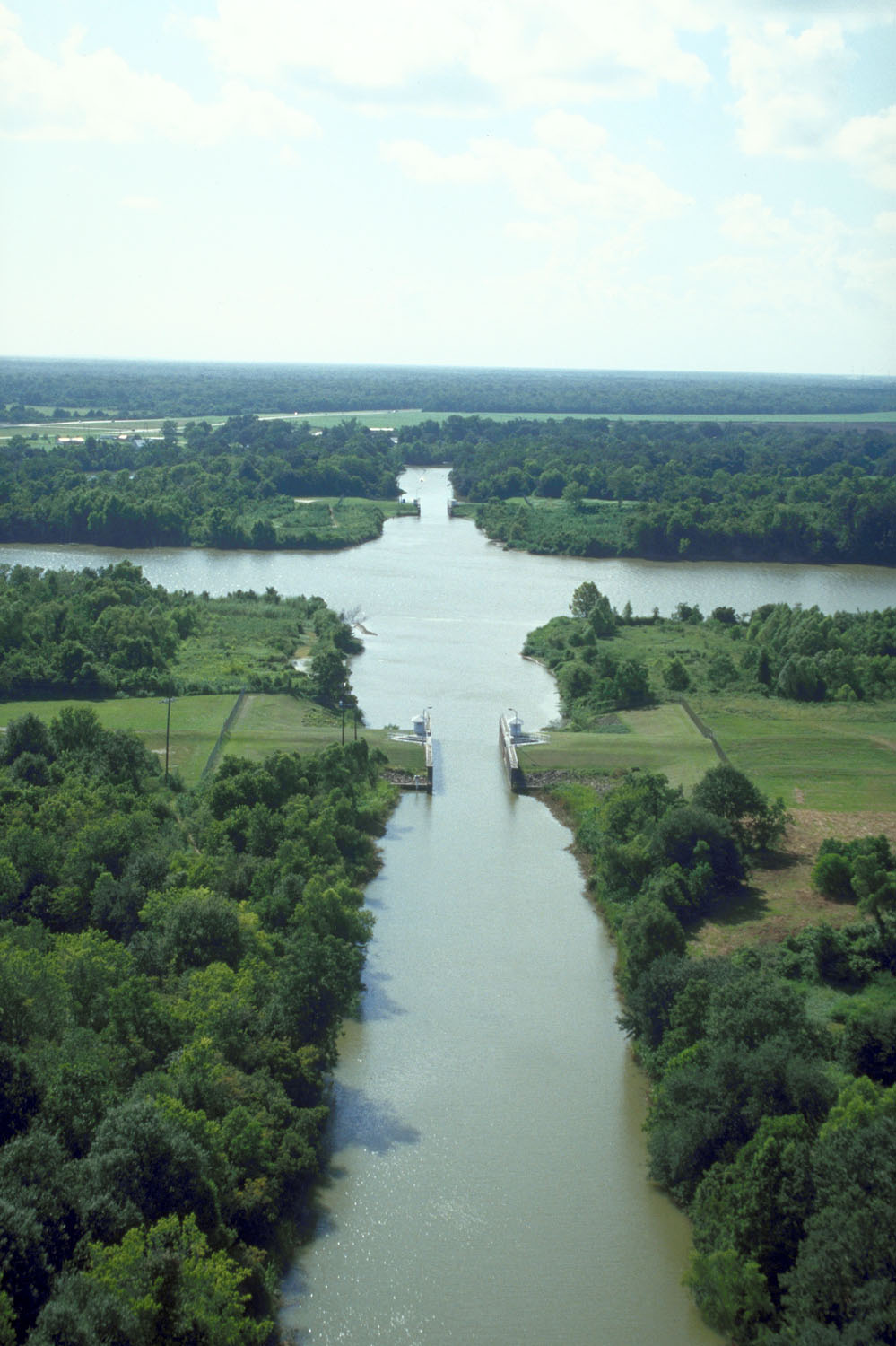
English: The intersection of Bayou Teche and the Wax Lake outlet of the Atachafalaya River near Patterson, Louisiana, USA. Bayou Teche runs straight up the center of the picture. The Wax Lake outlet of the Atchafalaya runs across left–right. The U.S. Army Corps of Engineers has built water control structures on the bayou where it intersects with the river. |
|||
| Date | ||||
| Source |
U.S. Army Corps of Engineers Digital Visual Library Image page Image description page Digital Visual Library home page |
|||
| Author | Michael Maples, U.S. Army Corps of Engineers | |||
| Permission (Reusing this file) |
|
|||
| Location | St. Mary Parish, Louisiana, USA |
| Camera location | | View this and other nearby images on: OpenStreetMap |
|---|
File history
Click on a date/time to view the file as it appeared at that time.
| Date/Time | Thumbnail | Dimensions | User | Comment | |
|---|---|---|---|---|---|
| current | 19:57, 7 April 2007 | | 999 × 1,500 (213 KB) | DanMS (talk | contribs) | {{Information | Description = {{en|The intersection of Bayou Teche and the Wax Lake outlet of the Atachafalaya River near Patterson, Louisiana, USA. Bayou Teche runs straight up the center of the picture. The Wax Lake outlet of the Atchafalaya runs acr |
You cannot overwrite this file.
File usage on Commons
The following page uses this file:
File usage on other wikis
The following other wikis use this file:
- Usage on ca.wikipedia.org
- Usage on ceb.wikipedia.org
- Usage on de.wikipedia.org
- Usage on en.wikipedia.org
- Usage on es.wikipedia.org
- Usage on fa.wikipedia.org
- Usage on fr.wikipedia.org
- Usage on pt.wikipedia.org
- Usage on www.wikidata.org