File:Belgian Railway Line 36C.png

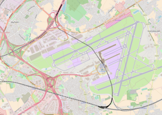
Size of this preview: 800 × 567 pixels. Other resolutions: 320 × 227 pixels | 640 × 454 pixels | 1,024 × 726 pixels | 1,405 × 996 pixels.
Original file (1,405 × 996 pixels, file size: 1.27 MB, MIME type: image/png)
Captions
Captions
Add a one-line explanation of what this file represents
Summary edit
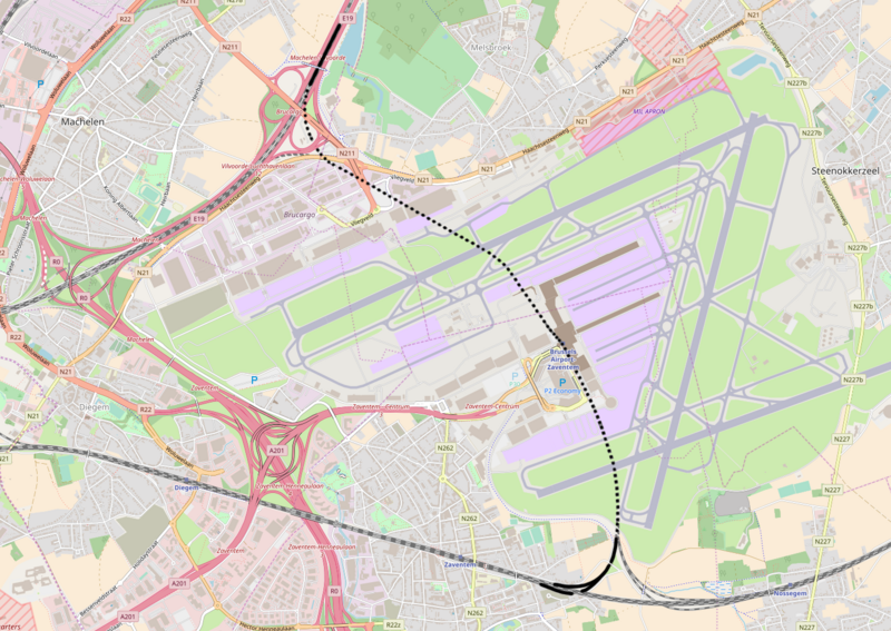
| Description | Belgian Railway Line 36C, Y Zaventem - Brussel-Nationaal-Luchthaven |
| Source | openstreetmap.org, see Relation: 94291 from the OpenStreetMap Belgium/Railways project. |
| Author | OpenStreetMap contributors |
| Permission (Reusing this file) |
All OpenStreetMap data and maps are Creative Commons "CC-BY-SA 2.0" licensed |
Licensing edit
This file is licensed under the Creative Commons Attribution-Share Alike 2.0 Generic license.
- You are free:
- to share – to copy, distribute and transmit the work
- to remix – to adapt the work
- Under the following conditions:
- attribution – You must give appropriate credit, provide a link to the license, and indicate if changes were made. You may do so in any reasonable manner, but not in any way that suggests the licensor endorses you or your use.
- share alike – If you remix, transform, or build upon the material, you must distribute your contributions under the same or compatible license as the original.
File history
Click on a date/time to view the file as it appeared at that time.
| Date/Time | Thumbnail | Dimensions | User | Comment | |
|---|---|---|---|---|---|
| current | 12:23, 21 November 2017 | | 1,405 × 996 (1.27 MB) | Vunz (talk | contribs) | fix |
| 21:48, 9 June 2012 |  | 1,463 × 1,109 (1.42 MB) | Vunz (talk | contribs) | line extended | |
| 15:26, 2 September 2010 |  | 1,052 × 763 (1.13 MB) | Vunz (talk | contribs) | ||
| 22:28, 30 September 2009 |  | 1,052 × 763 (1.13 MB) | Vunz (talk | contribs) | Spoorlijn 36C Category:Rail transport maps of Belgium | |
| 11:43, 17 January 2009 |  | 520 × 390 (24 KB) | Vunz (talk | contribs) | {{Information |Description={{nl|1=spoormap}} |Source=eigen werk (own work) |Author=Wiebevl |Date=17/01/2009 |Permission= |other_versions= }} <!--{{ImageUpload|full}}--> Category:Public domain maps from demis.nl [[Category:Rail transp |
You cannot overwrite this file.
File usage on Commons
The following 10 pages use this file:
- User:Chumwa/OgreBot/Potential transport maps/2017 November 21-30
- User:Chumwa/OgreBot/Public transport information/2017 November 21-30
- User:Chumwa/OgreBot/Transport Maps/2017 November 21-30
- User:Chumwa/OgreBot/Travel and communication maps/2017 November 21-30
- File:Spoorlijn36C.png (file redirect)
- Category:Line 36C (Infrabel)
File usage on other wikis
The following other wikis use this file:
- Usage on de.wikipedia.org
- Usage on ja.wikipedia.org
- Usage on ko.wikipedia.org
- Usage on nl.wikipedia.org
- Usage on www.wikidata.org