File:Bermondsey Met. B Ward Map 1916.svg

Size of this PNG preview of this SVG file: 800 × 536 pixels. Other resolutions: 320 × 214 pixels | 640 × 429 pixels | 1,024 × 686 pixels | 1,280 × 858 pixels | 2,560 × 1,716 pixels | 1,222 × 819 pixels.
Original file (SVG file, nominally 1,222 × 819 pixels, file size: 75 KB)
Captions
Captions
Add a one-line explanation of what this file represents
This W3C-unspecified vector image was created with Inkscape .
Summary edit
| Description |
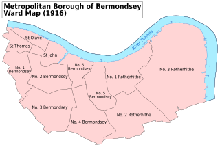
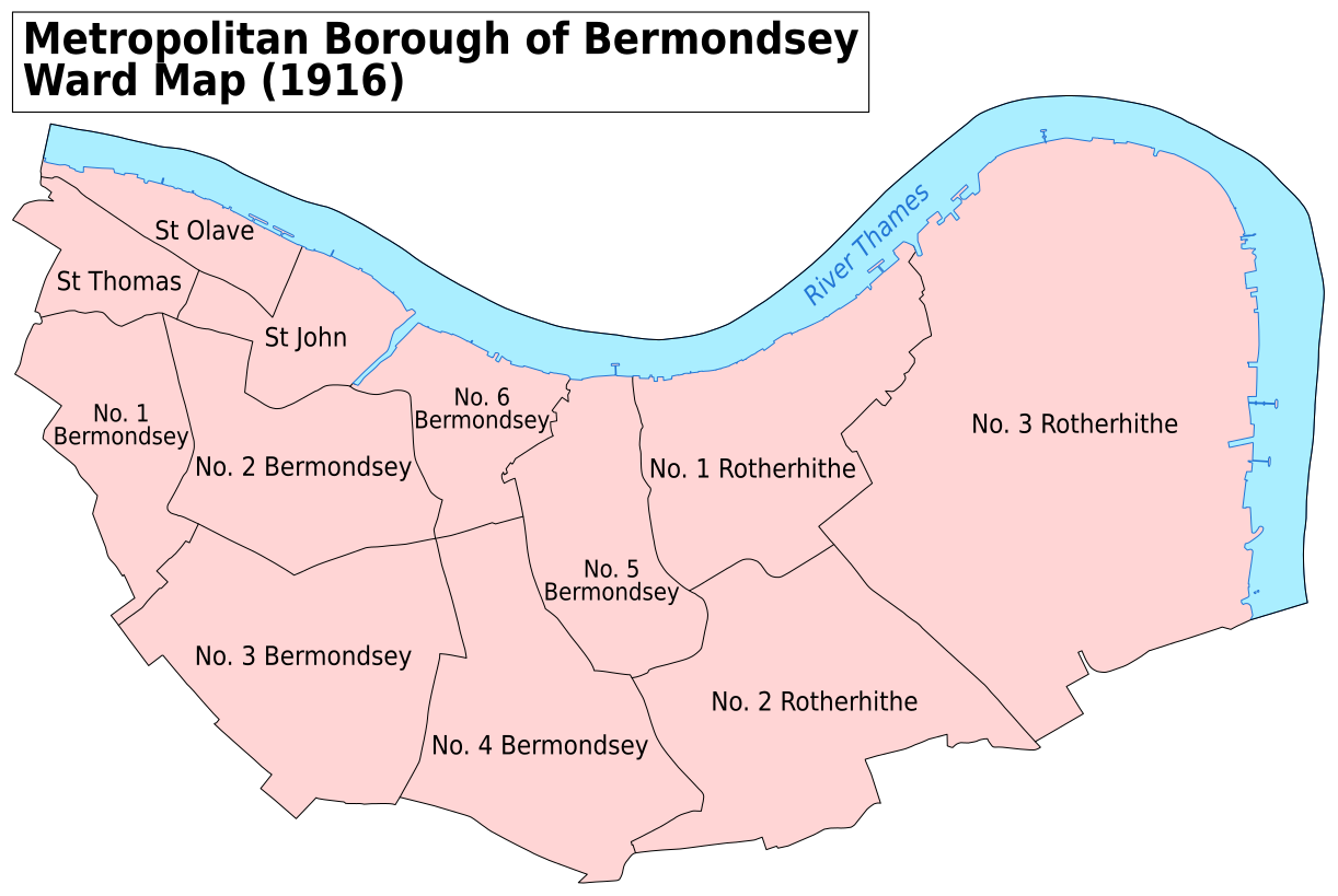
English: A map showing the wards of Bermondsey Metropolitan Borough as they appeared in 1916. Based on the Ordnance Survey 'County Series 3rd Edition' Map of London (1912-14) Sheets V12, V15, V16, IX3 & IX4 at 1:2500 scale. Accessed at http://maps.nls.uk/index.html Reproduced with the permission of the National Library of Scotland.
Key: District Boundaries River bank River |
| Date | |
| Source | Own work |
| Author | Doc77can |
Licensing edit
I, the copyright holder of this work, hereby publish it under the following license:
This file is licensed under the Creative Commons Attribution-Share Alike 4.0 International license.
- You are free:
- to share – to copy, distribute and transmit the work
- to remix – to adapt the work
- Under the following conditions:
- attribution – You must give appropriate credit, provide a link to the license, and indicate if changes were made. You may do so in any reasonable manner, but not in any way that suggests the licensor endorses you or your use.
- share alike – If you remix, transform, or build upon the material, you must distribute your contributions under the same or compatible license as the original.
File history
Click on a date/time to view the file as it appeared at that time.
| Date/Time | Thumbnail | Dimensions | User | Comment | |
|---|---|---|---|---|---|
| current | 22:27, 7 April 2016 | | 1,222 × 819 (75 KB) | Doc77can (talk | contribs) | Converted the labels from paths to text and changed the font. |
| 23:32, 16 May 2015 |  | 1,230 × 744 (373 KB) | Doc77can (talk | contribs) | User created page with UploadWizard |
You cannot overwrite this file.
File usage on Commons
The following 2 pages use this file:
File usage on other wikis
The following other wikis use this file:
- Usage on azb.wikipedia.org
- Usage on en.wikipedia.org
- Usage on es.wikipedia.org