File:Bermuda NLT Landsat7.png

Size of this preview: 800 × 580 pixels. Other resolutions: 320 × 232 pixels | 640 × 464 pixels | 1,056 × 765 pixels.
Original file (1,056 × 765 pixels, file size: 989 KB, MIME type: image/png)
Captions
Captions
Add a one-line explanation of what this file represents
| This image is in the public domain because it is a screenshot from NASA’s globe software World Wind using a public domain layer, such as Blue Marble, MODIS, Landsat, SRTM, USGS or GLOBE.
|
 |
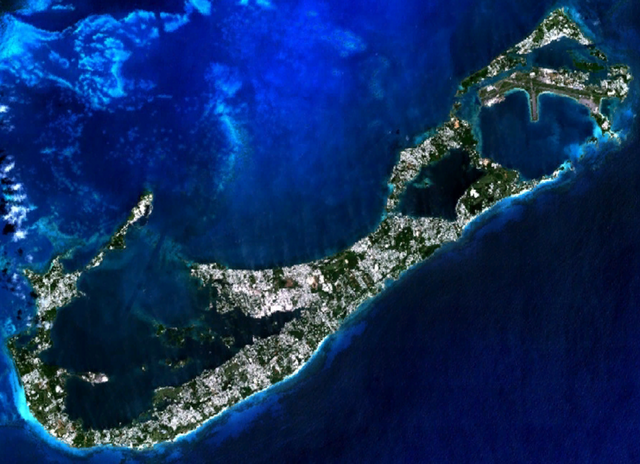
Visible colour satellite image of Bermuda.
Screenshot from NASA World Wind, NLT Landsat7 layer. Coordinates:
worldwind://goto/world=Earth&lat=32.31510&lon=-64.76256&alt=25664&tilt=1.0
File history
Click on a date/time to view the file as it appeared at that time.
| Date/Time | Thumbnail | Dimensions | User | Comment | |
|---|---|---|---|---|---|
| current | 20:58, 16 April 2006 | | 1,056 × 765 (989 KB) | Hautala (talk | contribs) | {{PD-WorldWind}} Visible colour satellite image of Bermuda. Screenshot from NASA World Wind, NLT Landsat7 layer. Coordinates: worldwind://goto/world=Earth&lat=32.31510&lon=-64.76256&alt=25664&tilt=1.0 |
You cannot overwrite this file.
File usage on Commons
There are no pages that use this file.
File usage on other wikis
The following other wikis use this file: