File:Bhv-semaphor hg.jpg
Size of this preview: 452 × 600 pixels. Other resolutions: 181 × 240 pixels | 362 × 480 pixels | 579 × 768 pixels | 772 × 1,024 pixels | 2,496 × 3,312 pixels.
Original file (2,496 × 3,312 pixels, file size: 812 KB, MIME type: image/jpeg)
Captions
Captions
Add a one-line explanation of what this file represents
| Description |
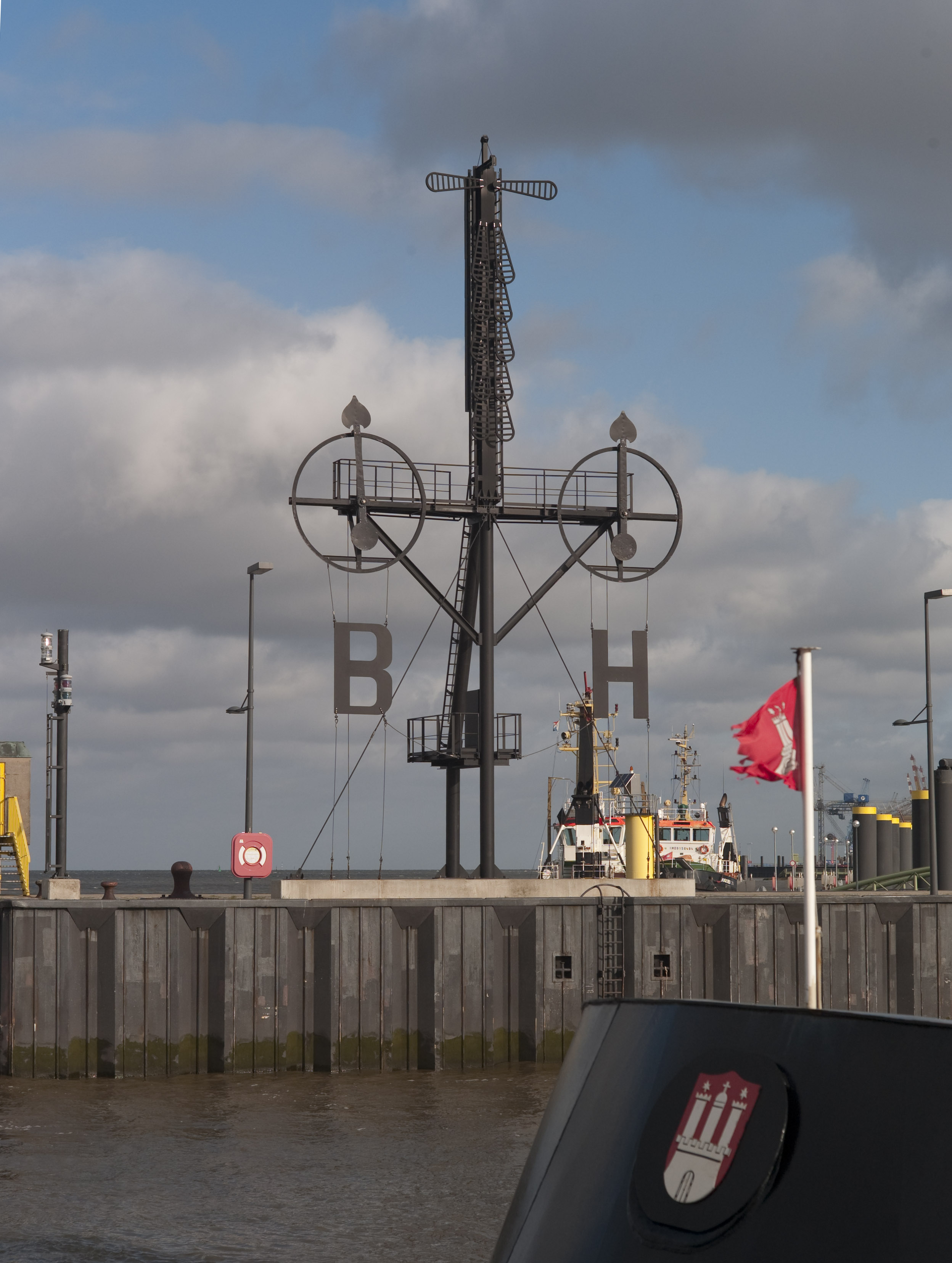
Deutsch: Semaphor in Bremerhaven
Das Semaphor stand auf der Landungsbrücke des Leuchtturms "Hohe Weg", 27 km nordwestlich von Bremerhaven in der Außenweser. Es diente von 1893 bis 1973 den in Richtung Nordsee fahrenden Schiffen als Hinweis auf die bei Borkum (B) und Helgoland (H) herrschende Windrichtung und Windstärke. Mit der Automatisierung der Leuchttürme wurde die Besatzung des Leuchtturms "Hohe Weg" abgezogen und damit das Semaphor stillgelegt. Das verrostete Stahlgerüst wurde 1976 abgebaut; die Windrosen blieben erhalten und wurden beim Neubau des Semaphor an der Einfahrt zur Sportboothafen-Schleuse wieder verwendet. |
| Date | |
| Source | Own work |
| Author | Hannes Grobe/AWI |
This file is licensed under the Creative Commons Attribution 3.0 Unported license.
- You are free:
- to share – to copy, distribute and transmit the work
- to remix – to adapt the work
- Under the following conditions:
- attribution – You must give appropriate credit, provide a link to the license, and indicate if changes were made. You may do so in any reasonable manner, but not in any way that suggests the licensor endorses you or your use.
File history
Click on a date/time to view the file as it appeared at that time.
| Date/Time | Thumbnail | Dimensions | User | Comment | |
|---|---|---|---|---|---|
| current | 20:01, 13 May 2010 | | 2,496 × 3,312 (812 KB) | Hgrobe (talk | contribs) |
You cannot overwrite this file.
File usage on Commons
The following page uses this file: