File:Birchip location map in Victoria.PNG
Size of this preview: 800 × 563 pixels. Other resolutions: 320 × 225 pixels | 640 × 450 pixels | 1,024 × 720 pixels | 1,280 × 900 pixels | 1,641 × 1,154 pixels.
Original file (1,641 × 1,154 pixels, file size: 135 KB, MIME type: image/png)
Captions
Captions
Add a one-line explanation of what this file represents
Summary edit
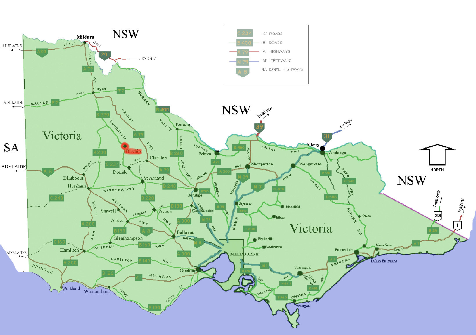
Shows location of w: Birchip, Victoria marked in red in the Australian state of w:Victoria. The map is a modified version of two of User:Fikri's GNU-licensed road maps of Victoria on wikipedia west and east
Licensing edit

|
Permission is granted to copy, distribute and/or modify this document under the terms of the GNU Free Documentation License, Version 1.2 or any later version published by the Free Software Foundation; with no Invariant Sections, no Front-Cover Texts, and no Back-Cover Texts. A copy of the license is included in the section entitled GNU Free Documentation License. |
| This file is licensed under the Creative Commons Attribution-Share Alike 3.0 Unported license. | ||
| ||
| This licensing tag was added to this file as part of the GFDL licensing update. |
File history
Click on a date/time to view the file as it appeared at that time.
| Date/Time | Thumbnail | Dimensions | User | Comment | |
|---|---|---|---|---|---|
| current | 23:49, 15 December 2005 | | 1,641 × 1,154 (135 KB) | Roke~commonswiki (talk | contribs) | Shows location of w: Birchip, Victoria marked in red in the Australian state of w:Victoria. The map is a modified version of two of User:Fikri's GNU-licensed road maps of Victoria on wikipedia [http://en.wikipedia.org/wiki/Image:WestVictoriaHwy.pn |
You cannot overwrite this file.
File usage on Commons
The following 2 pages use this file:
File usage on other wikis
The following other wikis use this file: