File:BlankMap-Europe-1791.png

No higher resolution available.
BlankMap-Europe-1791.png (470 × 486 pixels, file size: 17 KB, MIME type: image/png)
Captions
Captions
Add a one-line explanation of what this file represents
Summary edit
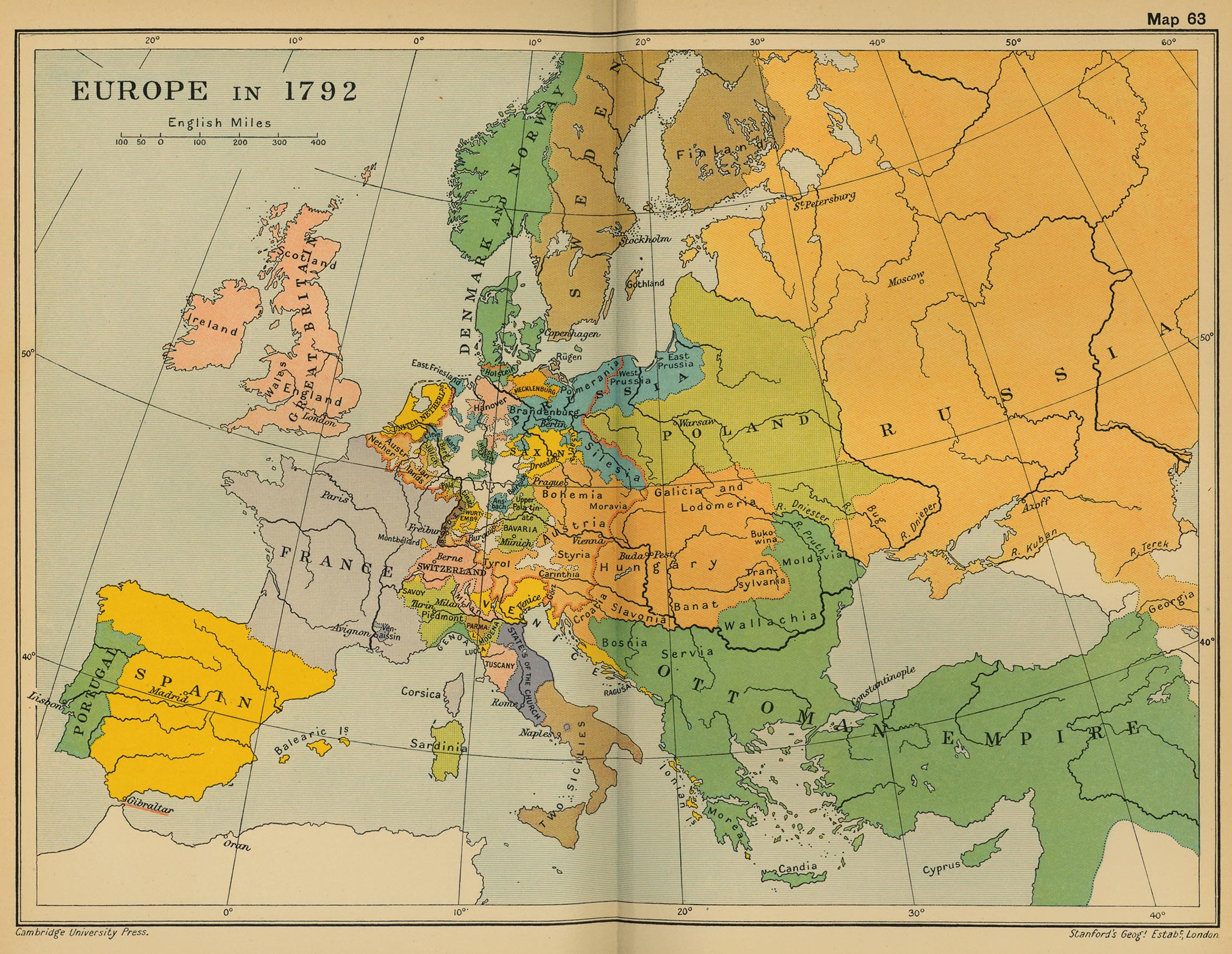
| Description | A blank map of Europe showing borders as of 1791 |
| Date | 31 July 2006 (original upload date) |
| Source | modification of Image:BlankMap-Europe-v3.png based on information in map hosted at University of Texas library |
| Author | Roke~commonswiki ultimately based on image by Vardion |
Licensing edit
I, the copyright holder of this work, hereby publish it under the following license:

|
Permission is granted to copy, distribute and/or modify this document under the terms of the GNU Free Documentation License, Version 1.2 or any later version published by the Free Software Foundation; with no Invariant Sections, no Front-Cover Texts, and no Back-Cover Texts. A copy of the license is included in the section entitled GNU Free Documentation License. |
| This file is licensed under the Creative Commons Attribution-Share Alike 3.0 Unported license. | ||
| ||
| This licensing tag was added to this file as part of the GFDL licensing update. |
File history
Click on a date/time to view the file as it appeared at that time.
| Date/Time | Thumbnail | Dimensions | User | Comment | |
|---|---|---|---|---|---|
| current | 09:16, 10 August 2006 | | 470 × 486 (17 KB) | Roke~commonswiki (talk | contribs) | sweden & finland same country, change sweden-russia border |
| 07:28, 31 July 2006 |  | 470 × 486 (17 KB) | Roke~commonswiki (talk | contribs) | blank map of europe showing borders for 1791 using Image:BlankMap-Europe-v3.png based on [http://www.lib.utexas.edu/maps/historical/ward_1912/europe_1792.jpg lib texas map] Category: Blank maps of Europe |
You cannot overwrite this file.
File usage on Commons
There are no pages that use this file.