File:Blank California Map TIGER2010.svg

Size of this PNG preview of this SVG file: 523 × 599 pixels. Other resolutions: 209 × 240 pixels | 419 × 480 pixels | 670 × 768 pixels | 893 × 1,024 pixels | 1,787 × 2,048 pixels | 630 × 722 pixels.
Original file (SVG file, nominally 630 × 722 pixels, file size: 4.05 MB)
Captions
Captions
Add a one-line explanation of what this file represents
Summary edit
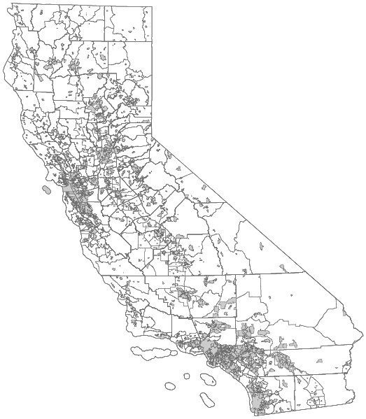
| Description | Blank political map of the US state of California. It includes the state boundaries, Metropolitan/Micropolitan Statistical Areas, Combined Statistical Areas, counties, county subdivisions, and incorporated and census designated places as recognized by the United States Census Bureau TIGER/Line for 2010. Uses a NAD83 California Teale Albers projection. | |||||
| Date | ||||||
| Source | United States Census Bureau TIGER/Line 2010 | |||||
| Author | int21h | |||||
| Permission (Reusing this file) |
|

File history
Click on a date/time to view the file as it appeared at that time.
| Date/Time | Thumbnail | Dimensions | User | Comment | |
|---|---|---|---|---|---|
| current | 07:31, 20 August 2011 | | 630 × 722 (4.05 MB) | Int21h (talk | contribs) | Crop canvas with Inkscape. |
| 05:25, 20 August 2011 |  | 968 × 791 (7.45 MB) | Int21h (talk | contribs) | Repositioned with more SVG parameters. | |
| 05:09, 20 August 2011 |  | 512 × 512 (7.51 MB) | Int21h (talk | contribs) | == {{int:filedesc}} == {{Information |Description=Blank political map of the US state of California. It includes the state boundaries, Metropolitan/Micropolitan Statistical Areas, Combined Statistical Areas, counties, county subdivisions, and incorporated |
You cannot overwrite this file.
File usage on Commons
There are no pages that use this file.