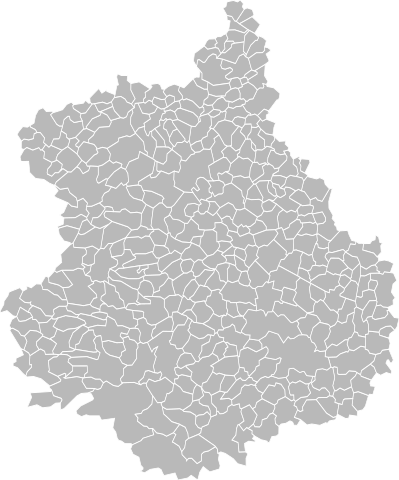
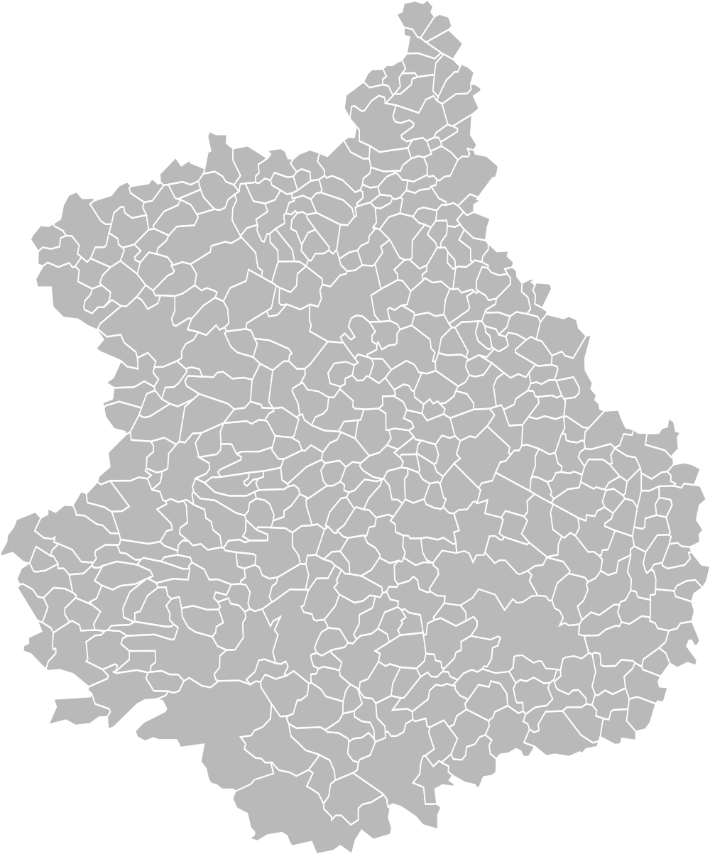
File:Blank Map of Eure-et-Loir Department, France, with Communes.svg

Size of this PNG preview of this SVG file: 498 × 599 pixels. Other resolutions: 199 × 240 pixels | 399 × 480 pixels | 638 × 768 pixels | 851 × 1,024 pixels | 1,702 × 2,048 pixels | 1,000 × 1,203 pixels.
Original file (SVG file, nominally 1,000 × 1,203 pixels, file size: 159 KB)
Captions
Captions
Add a one-line explanation of what this file represents
Summary edit
| Description |
English: Blank map of Eure-et-Loir department, France. Communes are outlined. Français : Carte vierge du département de l'Eure-et-Loir, France. Le découpage en communes est affiché. |
| Date | |
| Source | Own work |
| Author | Poulpy |
| Permission (Reusing this file) |
Coordinates are taken from GEOFLA® Communes, a work of Institut géographique national, licensed under the Licence Ouverte. |
Licensing edit
I, the copyright holder of this work, hereby publish it under the following license:
This file is licensed under the Creative Commons Attribution-Share Alike 3.0 Unported license.
- You are free:
- to share – to copy, distribute and transmit the work
- to remix – to adapt the work
- Under the following conditions:
- attribution – You must give appropriate credit, provide a link to the license, and indicate if changes were made. You may do so in any reasonable manner, but not in any way that suggests the licensor endorses you or your use.
- share alike – If you remix, transform, or build upon the material, you must distribute your contributions under the same or compatible license as the original.
File history
Click on a date/time to view the file as it appeared at that time.
| Date/Time | Thumbnail | Dimensions | User | Comment | |
|---|---|---|---|---|---|
| current | 15:21, 28 August 2023 | | 1,000 × 1,203 (159 KB) | Charpek (talk | contribs) | Update (new commune on 2023/1/1) |
| 16:30, 21 September 2018 |  | 1,067 × 1,283 (468 KB) | Sancta floris (talk | contribs) | Communes nouvelles au 01/01/2018. | |
| 09:14, 25 August 2017 |  | 1,000 × 1,203 (162 KB) | Xfigpower (talk | contribs) | new commune 2017 | |
| 13:47, 14 February 2016 |  | 1,000 × 1,203 (166 KB) | Pymouss (talk | contribs) | New communes on 2016/1/1 | |
| 20:53, 25 April 2012 |  | 1,000 × 1,203 (159 KB) | Poulpy (talk | contribs) | Names of communes included in file; better coordinates | |
| 23:20, 23 April 2012 |  | 512 × 612 (84 KB) | Poulpy (talk | contribs) |
You cannot overwrite this file.
File usage on Commons
The following page uses this file:
File usage on other wikis
The following other wikis use this file:
- Usage on fr.wikipedia.org